
CORVID-19 Hill-walking is great exercise and it is good to get out in the outside world and it is inherently safer and healthier than staying indoors. But we still lneed to take precautions whilst outside. Please do not go out walking if you are showing sisns of Corvid-19. When out walking make sure you give people space - 1m at least and preferable 2m. Remember that if it feels too crowded then walk away and try somewhere else. If you get into difficulty the MRT will come out to help you but they should not have to put themselves into danger from this virus. Take Care Out There.
Around Bamford Moor
| OS Map : | 110 |
| Start : | Cut-Throat Bridge Layby |
| SK216876 | |
| 335 | |
| This route starts at the North on the A57, Cut-Throat Bridge car park. This is a large layby used by walkers venturing north to the Derwent edges or south onto Moscar or Bamford Moor | |
| Summary : | Cut Throat Bridge - Jarvis Clough - Bamford Edge - Minor road - Stanage Edge - Jarvis clough - Cut Throat Bridge |
| distance : | 9.5km. |
| ascent : | 250m. |
| time : | 3hr. 20min. |

Bamford Edge from Win Hill
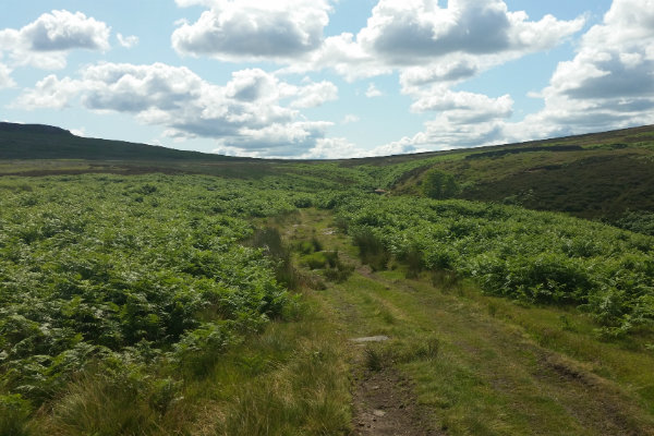
Walking up Jarvis Clough
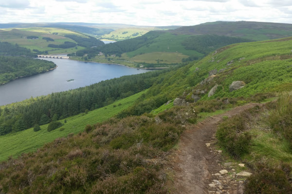
Bamford Edge looking north to the Ladybower reservoir
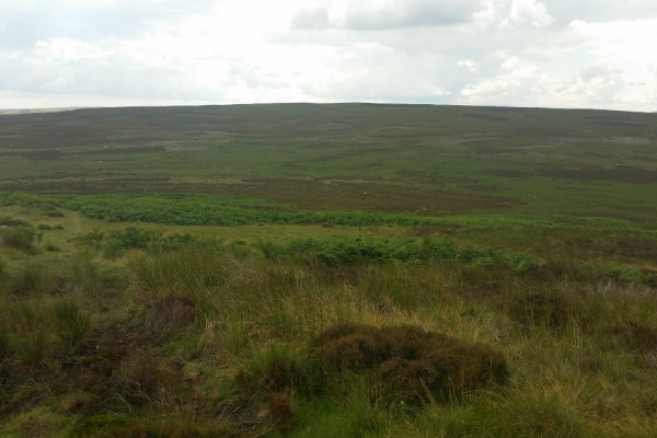
Over Bamford Moor
Edale
Current Weather
Last Updated today at : 20:59:52
| Overall : | scattered clouds |
| Temperature : | 22degC. |
| Wind Speed : | 16km/hr. |
| Wind Direction : | SW |
| Clouds : | scattered clouds |
| Precipitation : | none |
| Sunrise : | 03:40:52 |
| Sunset : | 20:39:30 |
| : | Times are GMT add 1 hour for BST |
Data from openweathermap.org
This route goes around Bamford Moor taking in Bamford and Stanage Edges. This moor has for many years been part of a private estate and walkers were not encouraged to walk over the moors except for the right of way that cuts across the area. In recent years, with the new legalisation, access to this moor has become easier. Consequently there are few paths in this area compared to the more popular parts of Edges. Much of Bamford Moor is wet underfoot with few disernable paths. This route keeps to the edge as much as possible. There are great views over to the west as well as over the moor to Stanage Edge.
Walk along the roadside, west, to reach the track opposite Cut-Throat Bridge itself. Take the track south under Hardon Edge to eventually come to the east bank of Jarvis Clough. Follow the track until it stops towards the top of Jarvis Clough. Cross the stream by the shooting shelter. There are some tracks here and you should aim to contour around the moor to reach the rocks at the northern limit of the edge. It is here that the history of the private moor is a disadvantage to the walker; there is no path here and it can be wet underfoot. Turn south and walk along the edge. As you climb to Great Tor the edge becomes more distinct. The views here, on a good day, are magnificent. To the east is Ladybower reservoir, Win Hill, and down to the village of Bamford itself. In the other direction there is a magnificent view of the great sweep of Stanage Edge. (3.5kms. 150m. 1hrs. 20min.)
From Great Tor follow the edge of the rocks south east until they reach the quarry and then continue down to the minor road. The right of way shown on the maps does not exist on the ground and yes, the walker can cut across the moor but it is a pathless fight through the heather and bracken. Best to follow the road around to reach the Denis Knowle Carpark whilst looking at the magnificant Stanage Edge. (2.5kms. 0m. 0hrs. 50min.)
From the car park follow the well defined track that climbs in a northerly direction until it meets the path below Stanage Edge. Once on this path follow it west then north. The path follows a line below Stanage giving great views of this edge. At some point the walker has to cross the moor to return to the starting point. At around 500m north of Crow Chin on Stanage Edge a line of grouse Butts is marked on the map and can be seen on the ground. make your way across the moor to meet Javis Clough around the end on the track. Follow the track back down and then around to meet the A57 at Cutthroat Bridge, with the car park just up the road. (3.5kms. 100m. 1hrs. 20min.)
 My Blog
© gritstoneedge.co.uk all rights reserved 2015-2026