
CORVID-19 Hill-walking is great exercise and it is good to get out in the outside world and it is inherently safer and healthier than staying indoors. But we still lneed to take precautions whilst outside. Please do not go out walking if you are showing sisns of Corvid-19. When out walking make sure you give people space - 1m at least and preferable 2m. Remember that if it feels too crowded then walk away and try somewhere else. If you get into difficulty the MRT will come out to help you but they should not have to put themselves into danger from this virus. Take Care Out There.
Kinder - Eastern Edge
| OS Map : | 110 |
| Start : | Edale Car Park. |
| SK125853 | |
| 235 | |
| The large pay car park at the road junction to Edale. This car park does get busy and there is a charge for it's use. | |
| Summary : | Edale - Ringing Rodger - Trig .590 - Madwomans Stones - Crookstone Knoll - Ringing Rodger - Edale |
| distance : | 9.5km. |
| ascent : | 380m. |
| time : | 3hr. 30min. |
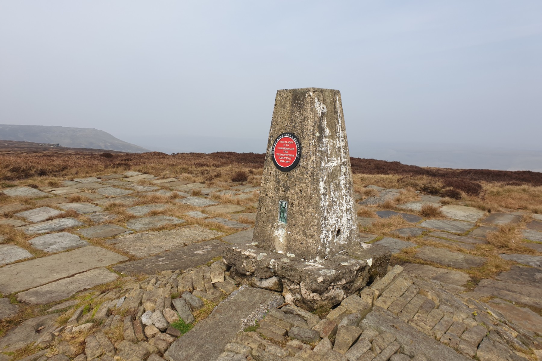
trig point at .590
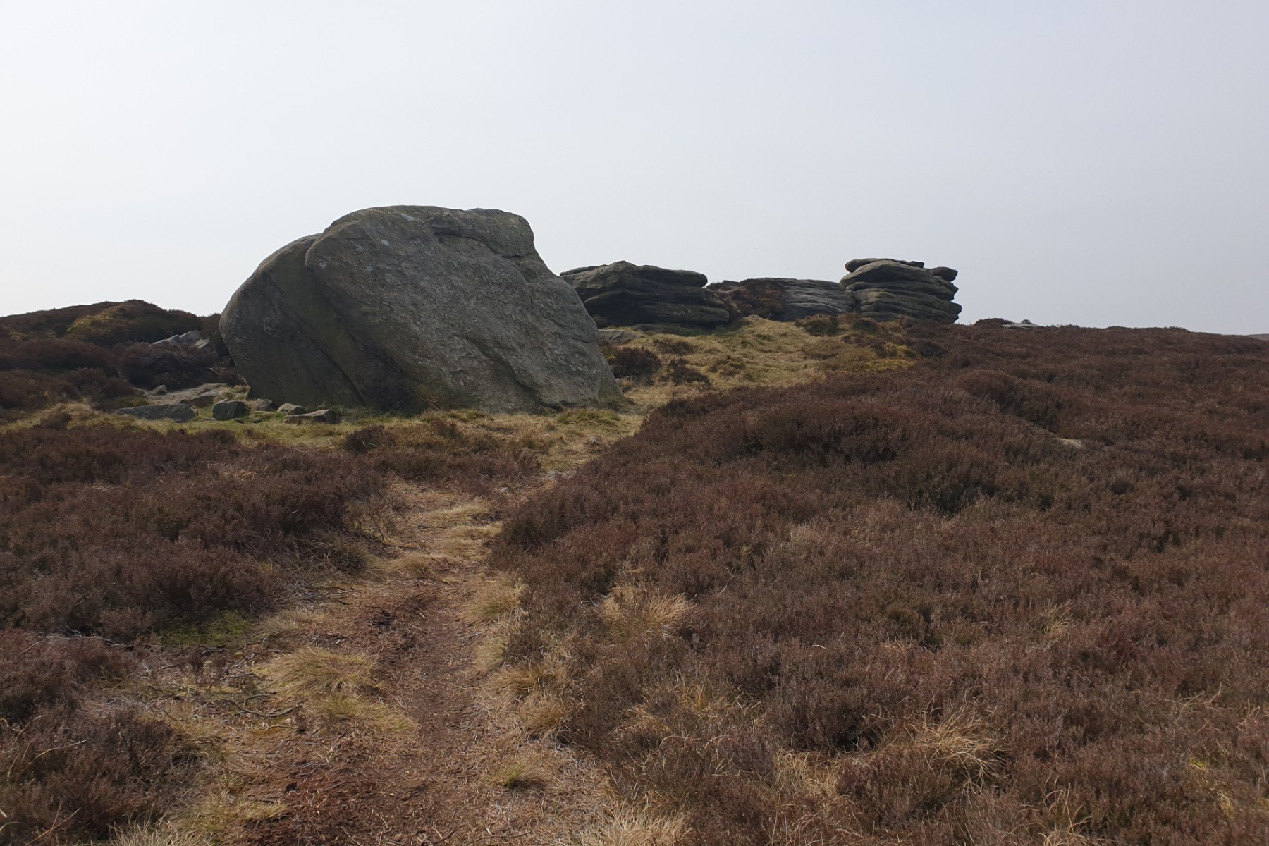
Madwomans Stones

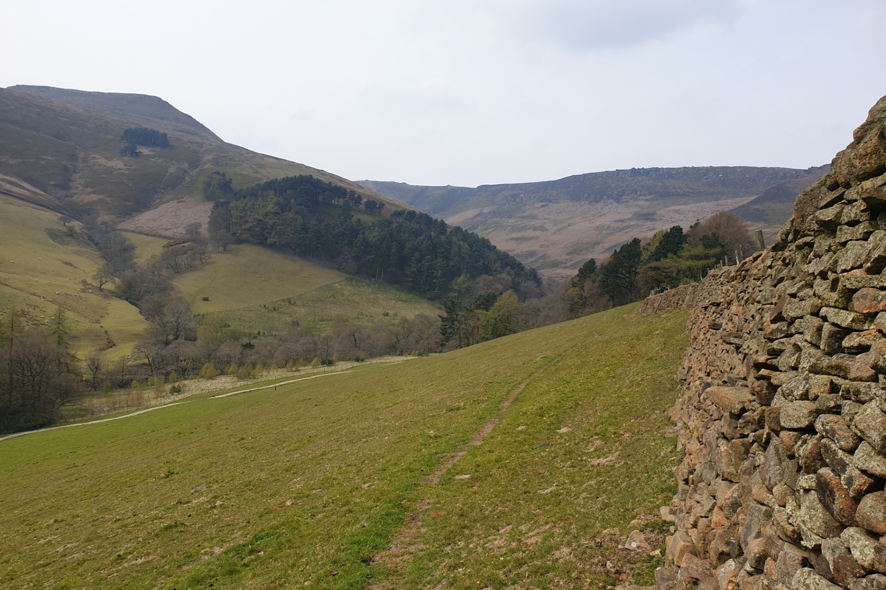
Looking west from Crookstone Edge
Looking up Grindsbrook
Edale
Current Weather
Last Updated today at : 20:58:10
| Overall : | scattered clouds |
| Temperature : | 22degC. |
| Wind Speed : | 16km/hr. |
| Wind Direction : | SW |
| Clouds : | scattered clouds |
| Precipitation : | none |
| Sunrise : | 03:40:52 |
| Sunset : | 20:39:30 |
| : | Times are GMT add 1 hour for BST |
Data from openweathermap.org
Kinder is a large and relatively flat plateau that dominates the northern part of the Peak District. It is justifiably popular. However this eastern aspect of the area is less popular and on many days the walker will be alone here. Views are of Win Hill, Lose Hill and Stanage Edge rather than over to the West and Manchester. A great place to get away from the crowds in this interesting part of Kinder. This route can be tacked from a number of starts. Here Edale is chosen as the start.
Leave the car park and walk up the road to the village, continue through the village to the start of Grindsbrook, signposted. Cross the rive and follow the path. Soon there is an obvious path turning right away from the main Grindsbrook path and climbing ringing Rodger. This steep path should be followed to the top of Ringing Rodger with it's interesting rock formations. Keep going for 100m to reach the edge path just north of the top. From here the route goes to the trig point at .590. There are no paths. make towards the fence and follow this around right (east) then north. From the top of this enclosure the trig point should be visible. Alternatively, take a bearing straight to the summit. The straight route crosses the enclosure by the stiles. Walk north to reach the edge path. There is a path, not marked on the maps, directly from the trig point to the edge. From here walk east around the northern edge path of Kinder. To visit Madwomann's Stones there is a path turning south of this edge path at around SK136882. Follow this to reach the stones. There are many stones on the top of Kinder and thes are another set of interesting rocks, with an interesting name. From the stones there is a path, again not shown on the map, that goes east until it reaches the marked path accross the edge at SK139880. Turn right and follow this path to the edge, then follow the edge path east to the eastern tip of the Kinder plateau at Crookstone Knoll. (5.0kms. 360m. 2hrs. 10min.)
From Crookstone Knoll the route returns to Ringing Rodger, This time via the path on the southern edge of Kinder. Once at Ringing Rodger return by the uphill route, down the southerly slopes via the definite path to the village and then onto the car park. There are many places in Edale where a cup of tea, or somethig stronger, may be purchased. (4.5kms. 20m. 1hrs. 20min.)
18th April 2019 Just before Easter on a warm day but sadly visibility was a bit murky. I have found where many schools take their DofE expeditions - here. A good walk around the east of Kinder but some of the paths are not as marked on the path. I always find Kinder an interesting place for rock formations, perhaps none more so than at Ringing Rodger.
 My Blog
© gritstoneedge.co.uk all rights reserved 2015-2026