
CORVID-19 Hill-walking is great exercise and it is good to get out in the outside world and it is inherently safer and healthier than staying indoors. But we still lneed to take precautions whilst outside. Please do not go out walking if you are showing sisns of Corvid-19. When out walking make sure you give people space - 1m at least and preferable 2m. Remember that if it feels too crowded then walk away and try somewhere else. If you get into difficulty the MRT will come out to help you but they should not have to put themselves into danger from this virus. Take Care Out There.
Howden Edge and Horse Stone
| OS Map : | 110 |
| Start : | Kings Tree |
| SK169950 | |
| 270 | |
| There is limited car parking at the end of the road on the side of Howden reservoir. The road from Fairholms, at the end of Ladybower Reservoir, is closed at the weekend and on Public Holidays from Easter to October. So this is a walk for midweek. | |
| Summary : | Kings Tree - Hoar Clough - Featherbed Moss - Howden Edge - Horse Stone - Kings Tree. |
| distance : | 12.0km. |
| ascent : | 260m. |
| time : | 4hr. 0min. |
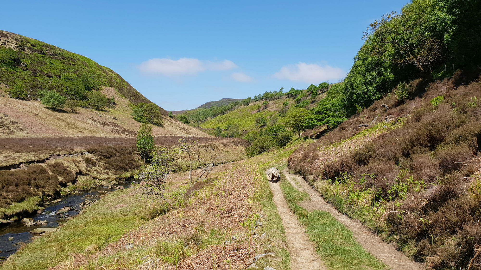
Walking up the River Derwent

View up Hoar Clough

View down the Derwent Valley
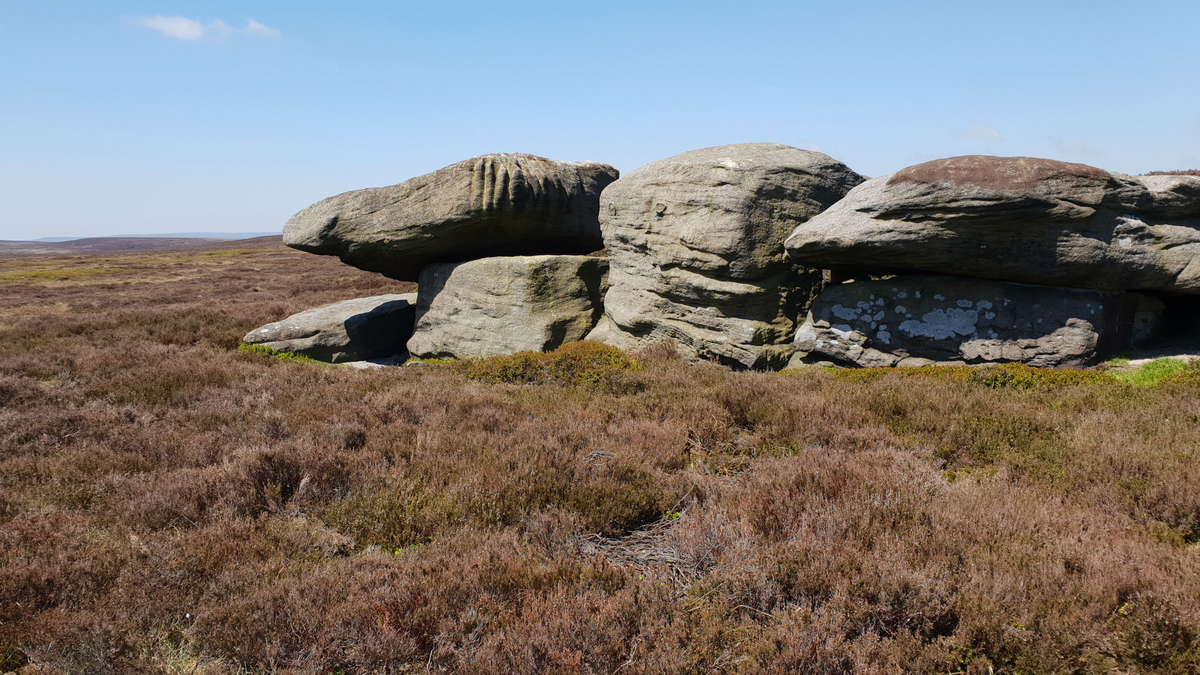
Hoar Stones

Horse Stone
Edale
Current Weather
Last Updated today at : 20:59:52
| Overall : | scattered clouds |
| Temperature : | 22degC. |
| Wind Speed : | 16km/hr. |
| Wind Direction : | SW |
| Clouds : | scattered clouds |
| Precipitation : | none |
| Sunrise : | 03:40:52 |
| Sunset : | 20:39:30 |
| : | Times are GMT add 1 hour for BST |
Data from openweathermap.org
The Derwent Valley splits Bleaklow between the large plateau to the west and the edges to the east. This walk goes up the pleasant Derwent Valley and then onto the eastern edges with their extensive views over South Yorkshire and beyond. A great area to get away from it all in this popular part of the country.
Go through the gate and follow the path to Slippery Slopes, and over the river Derwent via the Pack Horse Bridge. From here the route follows the track along the Derwent valley. Just past Stannery Clough the track becomes a path but still follow this to Hoar Clough. Follow the path up Hoar Clough, up the true left bank towards the ridge. Shepherds Meeting Point is an intersting set o rocks seen on the opposite bank on the ascent. As the clough flattens out the path crosses the river and makes for the ridge of Featherbed Moss. In fact there are many paths here and also the upper part of Hoar Clough has some very deep groughs. This is a remote part of the Peak District but the most striking part of the view is over to the Woodhead Pass and Barnsley. Looking over to the Woodhead Pass it is clear why this suffers from snow closures in winter. The ridge over Featherbed Moss is often wet; the name gives it away. However there has been a lot of conservation work taking place to attempt to reduce the erosion in the area. The results have been positive and the area is not as wet as it has been in the past. The route keeps as much as possible to the boundary line, the high ground over to Howden Edge. Hoar Stones are set just below the ridge and worth a visit on the way. A detour to Hoar Stone should be from the ridge and back, any contemplation of cutting corners here will end in large groughs. (7.5kms. 210m. 2hrs. 40min.)
Don't be conned to make directly to Horse Stone, there are a number of very deep and wet groughs to cross. From Howden Edge continue along the ridge to SK158983. From here it is an easier approach to the rounded hill of Horse Stone. The rocks around this part of the Peak District are most interesting so take in the view from Bleaklow Stones around to Crow Stones Edge. To descend follow Horse Naze, the rocks on the west down to the valley; pathless but sheep tracks can be found. Make for Little Stannery Clough and then joining Stannery Clough to reach the Derwent track at the bottom. Follow the valley back down to Kings Tree. When walking up the valley the land closes in, moving to a wilder environment; the way back opens out giving a more expansive view down the Derwent Valley. (4.5kms. 50m. 1hrs. 30min.)
1st May 2019 Followed the route out as described here. There has been a fair amount of rain recently but the ridge was not seriously wet. Rather than cut down to Horse Stone, I followed the ridge the full length to Outer Edge and then onto Cut Gate. From here I descended to the valley bottom. An interesting variation of this walk. There are reasonable paths all along the ridge much improved with the conservation work of damming the groughs and installing hessian sacks along the path. Apart from around the honey-pot of Kings Tree I saw no other walkers which was surprising as this was a nice spring may Day.
22nd May 2018 In an attempt to get a dry experience with this route, I attempted it after a prolonged dry period. Underfood was not wet at all which was great. On the top ridge, Featherbed Moss to Howden Edge, work has been carried out to stop the erosion and to dry out some of the areas. Once away from the main track / path along the River Derwent there are few paths. I followed the small sheep tracks which are often better than those marked on the OS maps. A great walk in the sunshine.
 My Blog
© gritstoneedge.co.uk all rights reserved 2015-2026