
CORVID-19 Hill-walking is great exercise and it is good to get out in the outside world and it is inherently safer and healthier than staying indoors. But we still lneed to take precautions whilst outside. Please do not go out walking if you are showing sisns of Corvid-19. When out walking make sure you give people space - 1m at least and preferable 2m. Remember that if it feels too crowded then walk away and try somewhere else. If you get into difficulty the MRT will come out to help you but they should not have to put themselves into danger from this virus. Take Care Out There.
Grinah and Barrow Stones
| OS Map : | 110 |
| Start : | Kings Tree |
| SK169950 | |
| 270 | |
| There is limited car parking at the end of the road on the side of Howden reservoir. The road from Fairholms, at the end of Ladybower Reservoir, is closed at the weekend and on Public Holidays from Easter to October. So this is a walk for midweek. | |
| Summary : | Kings Tree - Ridge Nether Moor - Round Hill - Barrow Stones - Grinah Stones - Round Hill - Lower Small Clough - River Derwent - Kings Tree |
| distance : | 13.0km. |
| ascent : | 360m. |
| time : | 4hr. 30min. |
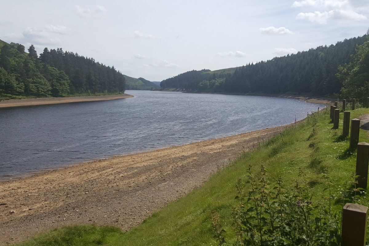
View down Howden Reservoir from Kings Tree

Barrow Stones
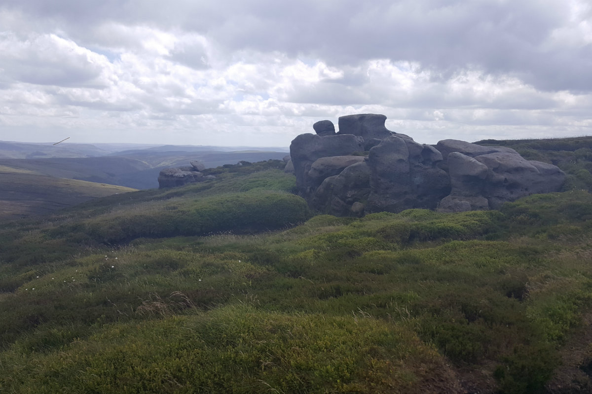
Barrow Stones

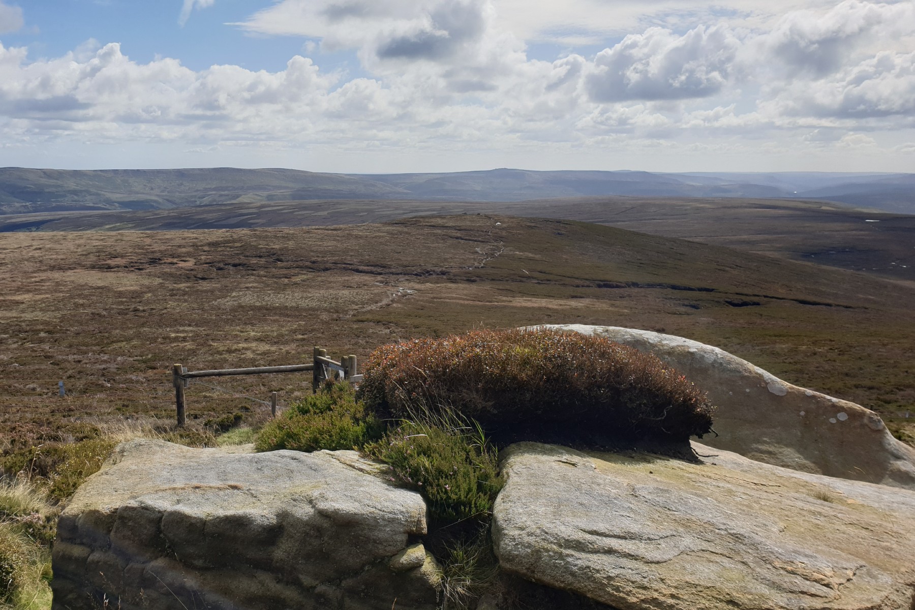
Shelter at Round Hill

Source of Derwent

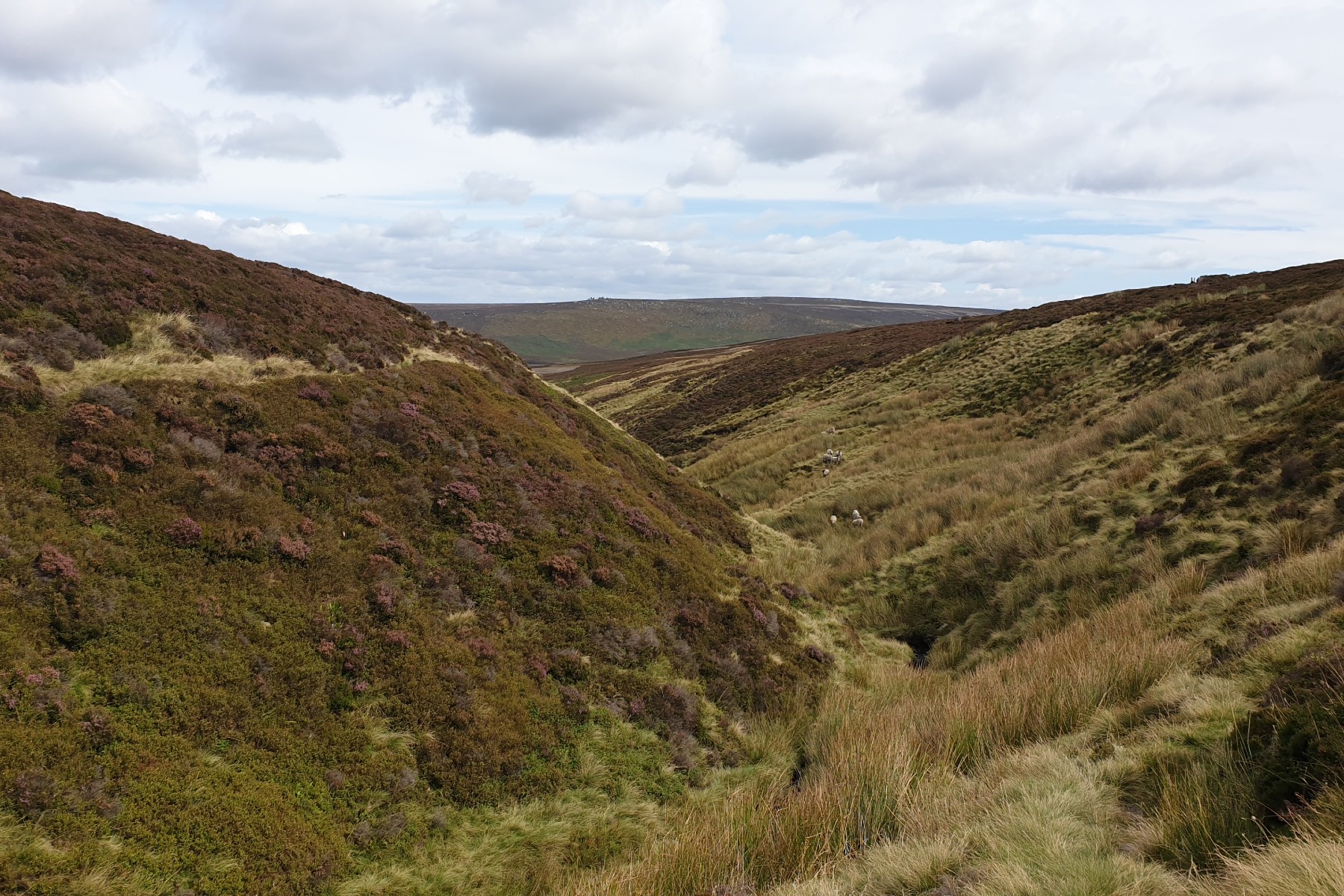
Grinah and Barrow Stones behind Round Hill
View to Derwent Edges
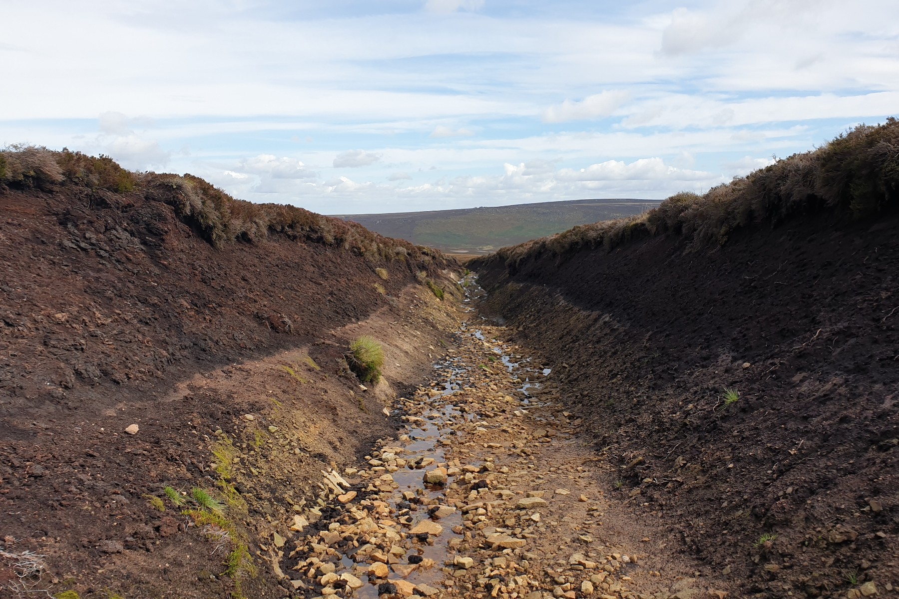
Down Lower Small Clough

Cabins at Lower Small Clough
Top of Derwent Valley.
Edale
Current Weather
Last Updated today at : 20:58:10
| Overall : | scattered clouds |
| Temperature : | 22degC. |
| Wind Speed : | 16km/hr. |
| Wind Direction : | SW |
| Clouds : | scattered clouds |
| Precipitation : | none |
| Sunrise : | 03:40:52 |
| Sunset : | 20:39:30 |
| : | Times are GMT add 1 hour for BST |
Data from openweathermap.org
The top of the Howden reservoir has some very rough, sometimes wet, and wild moorland. But don't be put off as there is a special magic to this area of the Peak District. The walk starts at King's Tree and then reaches the interesting stones at Grinah and Barrow Stones before descending Lower Small Clough and back alongside the River Derwent.
There are many ways to do this walk. The suggested route is to gain the high ground via Linch Clough. Go through the gate at the end of the road. Cross the bridge and the path up Linch Clough is on the left. Follow this path on the right of the stream until it fades out. Cross the stream and follow the path up and around the slopes of the south west bank of Linch Clough. Follow this path around to the ridge. The top section ay be wet, so turn uphill to reach the bottom of Black Dyke Drain. This is not marked on the 1:50,000 map but does clearly exist. It gives a good route up the ridge, with perhaps wet areas which are easily avoided. Walk along the drain and from the end of it there is a well marked path that ascends Round Hill. Again this land can be wet, but a bit of jumping avoids the main areas. Follow this path to the bottom of Round Hill and make for the summit via the stony ridge. There is a good round shelter marking the summit. (4.0kms. 280m. 1hrs. 50min.)
Leave Round Hill and walk over to Barrow Stones following the small path. There is a fence surrounding Bleaklow just below Barrow Stones, to keep sheep out. Once Barrow Stones is reached it is worth exloring around to see the many fine rock sculptures in the area. The source of the River Derwent is just around the corner at SK132967. There is a sign as well. The whole area is a mix of groughs, peat and water so the exact position of the source is a matter fro debate. Leave Barrow Stones using the path that contours around the edge to Grinah Stones, which is just down from the skyline. Again it is worth exploring around Grinah Stones. Both Barrow Stones and Grinah Stones have have impressive rock formations that stand out amongst the moorland of the Upper Derwent Valley. (1.0kms. 80m. 0hrs. 30min.)
The first part of the descent is to retrace the uphill route back to Barrow Stones and Round Hill, following the paths that contour the slopes. Descend Round Hill via the marked path, and down to the start of Black Dike Drain. Just after the start of the drain, there is a track climbing from Westend and a path down Lower Small Clough (SK141955). It is this latter path that the walker follows. Here there is a well marked path down Lower Small Clough. This first passes Round Hill Cabins, that are not round! Continue down the clough on the path to reach the main valley. It should not be too difficult to cross the Derwent in normal conditions. Once across, climb the grassy slopes steeply to reach the track. Follow this good track alongside the River Derwent down to Slippery Stones bridge and then back to Kings Tree. (8.0kms. 0m. 2hrs. 20min.)
4th August 2021 A slight variation of the route. Parked at Westend and walked up the track to the ridge below Round Hill. Then up Round Hill and over to Barrow Stones. Another hunt for the -source of the Derwent- which is still there. A walk over to Grinah Stones. Then back to Round Hill and then down the ridge, including down the Black Dike Drain. Continued down and then down the tracks shown in the forest to meet the road. A great day out and despite this being mid-summer hardly anyone else out on the moors.
5th September 2019 A nice day of sunshine but a moderate breeze following on from a few wet days and a wet summer. I should have known that this would mean wet underfoot conditions. The path up from Linch Clough to the ridge was very wet towards the top meaning that a dryer route needed to be found. One on the top, the ground was saturated even so the path is obvious and although not dry it was firm. Every so often a jump over the water was needed. Once at Barrow Stones, a wander about to find the source of the River Derwent. Could be anywhere up there but there is a plaque. A nice walk down Lower Small Clough onto the Derwent valley at the end.
9th April 2019 A great day in sprimg sunshine but a bit of wind. Throughout, except for around Kings Tree, only a couple of other walkers were met. This indeed is a remote area of the Peak District. Underfoot was quite wet in places but with jumping wet feet can be avoided. For the safety conscious or the social media adicts, this area has poor mobile phone coverage.
 My Blog
© gritstoneedge.co.uk all rights reserved 2015-2026