
CORVID-19 Hill-walking is great exercise and it is good to get out in the outside world and it is inherently safer and healthier than staying indoors. But we still lneed to take precautions whilst outside. Please do not go out walking if you are showing sisns of Corvid-19. When out walking make sure you give people space - 1m at least and preferable 2m. Remember that if it feels too crowded then walk away and try somewhere else. If you get into difficulty the MRT will come out to help you but they should not have to put themselves into danger from this virus. Take Care Out There.
Eastern Edges from Chatsworth to Derwent.
| OS Map : | 110 |
| Start : | Chatsworth Estate Car Park. |
| SK261703 | |
| 100 | |
| Follow the B6012 from Baslow and then thesigns to Chatsworth House. This leads to the estate car park. Current cost is £4. | |
| Summary : | Chatsworth House - Chatsworth Edge - Birchen Edge - Baslow Edge - Curbar Edge - Froggatt Edge - Burbage Edges - Stanage Edge - Derwent edges - Fairholms. |
| distance : | 35.0km. |
| ascent : | 830m. |
| time : | 11hr. 40min. |

View north towards Birchen Edge from Dobb Edge
Birchens Edge

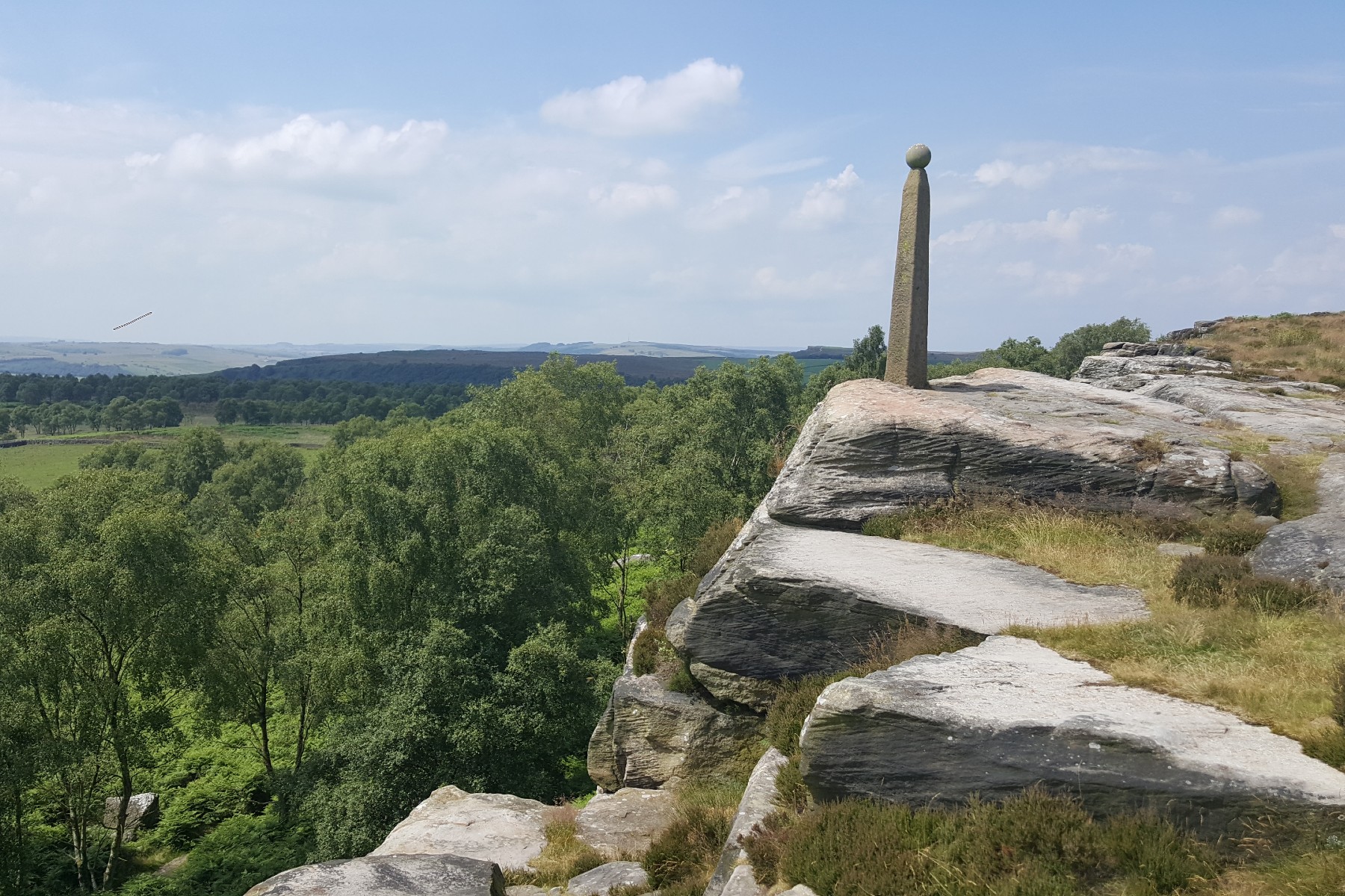
Wellington Monument at the south of baslow Edge.

South from Curbar Edge

Top of Froggatt Edge

View of South Burbage
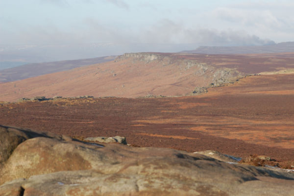
View of Stanage Edge from Southern trig .457
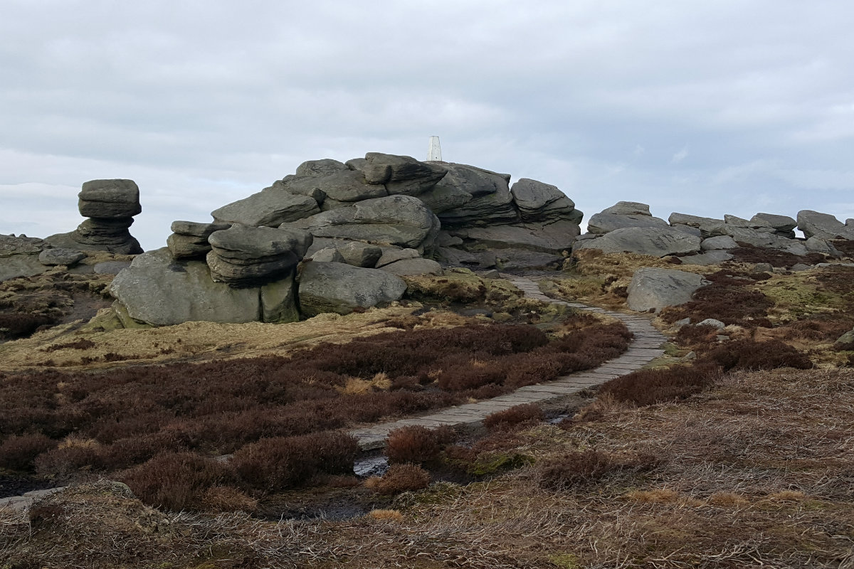
Back Tor at the far point of the edge.
Edale
Current Weather
Last Updated today at : 20:58:10
| Overall : | scattered clouds |
| Temperature : | 22degC. |
| Wind Speed : | 16km/hr. |
| Wind Direction : | SW |
| Clouds : | scattered clouds |
| Precipitation : | none |
| Sunrise : | 03:40:52 |
| Sunset : | 20:39:30 |
| : | Times are GMT add 1 hour for BST |
Data from openweathermap.org
The Eastern Edges run from Chatsworth in the south to Derwent in the north in a near continuos line if gritstone outcrops. This is a unique environment; nowhere else in the UK has such an extended line of natural craggy edges; this is the unique selling point for the Peak District It is a significant challenge to walk the length of these edges. Due to the predominant weather in the area the route is described south to north. This als means that as you progress along the route, the scenery gets wilder; moving from elegance of Chatsworth House to the wilds of Bleaklow. This is a linear walk, so it is essentail to arrange transport to the start and from the finish.
Chatsworth Edge : From the car park follow the well marked route around the back of the buildings and climbing to the prominent Hunting Tower. From here the route takes the high ground north. Continue along the road and through the stile onto Dobbs Edge, not a significant edge. There is a path along the top of the edge which meets a wall. Another stile allows the walker through. This is Chatsworth edge. The edge looks very overgrown from the top but the true scale is seen from below. Follow the top of the edge, until the path reaches a prow at the northern end of Chatsworth. From here descend the path, cross the river and climb up to the A621. Turn right and follow the road for 400m to reach the Robin Hood Inn. (4.5kms. 150m. 1hrs. 40min.)
Birchens edge : From the Inn walk a few meters up the minor road to find the start of the path along Birchens edge. The path leaves the wooded area and climbs steadily to break onto the top of the crag. With the edge below you on the left follow the path along, making at all times for Nelson's Monument. There are no paths marked on the map from the monument and the route takes the walker to the cross roads at SK278740. On the ground there are various tracks through the bracken. The most obvious route curves along the remnants of the edge and then follows an arc over the moor to the gate near the cross roads. (2.0kms. 90m. 0hrs. 50min.)
Baslow Edge : From the road junction walk 200m along the minor road in a NW direction that leads to the gate with the track that leads t Wellington's Monument. Follow this track passed the monument and take the proninent track along the top of Baslow Edge. Just before the minor road is met at Curbar Gap, take a rest at the thoughtfully placed bench. Alternativly the tea-van is in the car park at Curbar Gap! (2.5kms. 90m. 1hrs. 0min.)
Curbar and Froggatt Edge : This section of the route follows the top of Curbar and then Frogggatt Edges. There is a drop at SK248763 where Curbar finished and Froggatt starts but for the walker this split looks insignificant. Follow the path on top of Curbar and then Froggatt Edge. At the north of Froggatt Edge the route goes into some trees, follow this path and meet the A625 at a white gate. There is a definite break in the edges here. Walk along the road to the Grouse Inn. There is a good verge on the east side of the road, making this not as dangerous as it could be. Continue on past the Grouse Inn, maybe popping in if time allows, to the second significant track on the left. This track takes the walker through Longshaw estate, past the Lodge to reach the B6521 just down from Fox House, another good place for a rest. (6.0kms. 100m. 2hrs. 0min.)
Burbage Edge : From the road, walk 50m uphill to reach the footpath that takes the walker to the start of Green Drive that climbs through the Burbage Valley. Rather than taking the Green Drive, follow the footpath that climbs to the top of Burbage South Edge. The quarries are obvious at the start. Then follow the path at the top of the edge. Descend to the small valley and then climb again to reach the top of Burbage North Edge. Follow the top of the edge to reach Burbage Bridge. (3.0kms. 200m. 1hrs. 20min.)
Stanage Edge : Stanage Edge is the most prominent and best of all these eastern edges. From the car park at Burbage Bridge take the footpath over the moor to climb to the top of the edge at Cowper Stone. From here it is just follow the edge. First significant point is the trig point .457. From here there is a great view north encompassing the full sweep of Stanage Edge - magnificant. This view is different but equally good in any season, whether this is the snows of winter, fresh growth of spring, heat of summer of gold of autumn. The route goes north to reach the Roman Raod with Stanage Pole on the east. Again keep walking north along the top and eventually reach the high point of Stanage, High Neb .458. Now the quieter part of Stanage. Follow the route north and slowly descending to reach a wall that marks Stanage Edge. From here the natural path along the edge takes the walker to the A57. (6.0kms. 50m. 1hrs. 50min.)
Derwent Edge : Walk west alongside the busy A57 to reach the small Strines Road. Follow this road for 100m to a lane and follow this for a further 200m. There are well marked footpaths in this area and the route takes the southern path to (nearly) Cut Throat Bridge and then over the Moors to Whinstone Lee Tor. The final edge, Derwent Edge is more broken but the rock formations are exceptional. Walk uphill on good paths to Hurkling Stones, Wheel Stones, White tor, past the Salt Celler lower down on left, onto Dovestone Tor, Cakes of Bread and Back Tor. The route here now descends to Derwent Reservoir. Take the well made path to Lost Lad around the top of Far Deep Clough and down the footpath of Pike Tor to reach the building. Follow the track west to reach the road along the reservoir and then around the head of Ladybower to Fairholms car park. (11.0kms. 150m. 3hrs. 30min.)
 My Blog
© gritstoneedge.co.uk all rights reserved 2015-2026