
CORVID-19 Hill-walking is great exercise and it is good to get out in the outside world and it is inherently safer and healthier than staying indoors. But we still lneed to take precautions whilst outside. Please do not go out walking if you are showing sisns of Corvid-19. When out walking make sure you give people space - 1m at least and preferable 2m. Remember that if it feels too crowded then walk away and try somewhere else. If you get into difficulty the MRT will come out to help you but they should not have to put themselves into danger from this virus. Take Care Out There.
Hallam and Burbage Moor.
| OS Map : | 110 |
| Start : | Car Park - Redmires Car Park |
| SK257851 | |
| 350 | |
| Take Redmires Road up to Lodge Moor and then beyond to Redmires Reservoir. There is a car park on the north side the the upper Redmires Reservoir. Muddy but free. | |
| Summary : | Redmires Reservoir - Stanage Pole - Stanage Edge - Burbage Bridge - Houndkirk Moor - Lady Canning Plantation - Rud Hill - Redmires Reservoir |
| distance : | 12.0km. |
| ascent : | 150m. |
| time : | 3hr. 50min. |
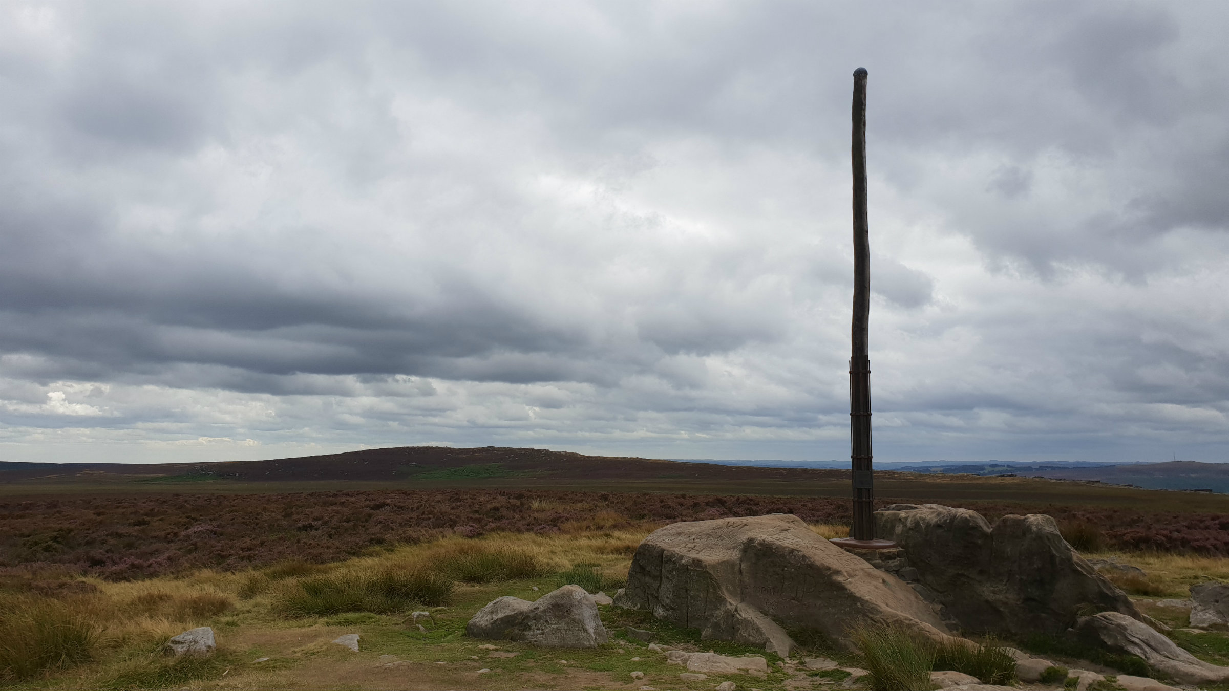
Stanage Pole
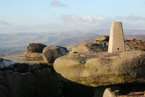
Summit trig .457

Burbage Bridge.

Ox Stones trig

Look back from Rud Hill.
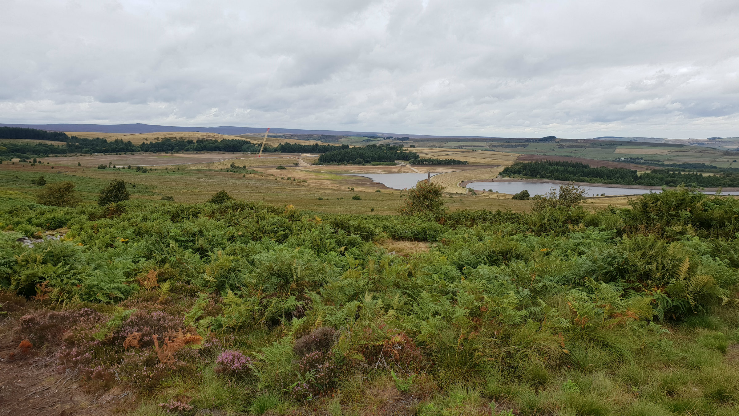
Redmires under repair
Edale
Current Weather
Last Updated today at : 19:40:47
| Overall : | broken clouds |
| Temperature : | 23degC. |
| Wind Speed : | 16km/hr. |
| Wind Direction : | SSW |
| Clouds : | broken clouds |
| Precipitation : | none |
| Sunrise : | 03:40:52 |
| Sunset : | 20:39:30 |
| : | Times are GMT add 1 hour for BST |
Data from openweathermap.org
Hallam and Burbage Moors are large tracts of typical Peak District moor. The edges of the moor make for a good walk including, as it does, Stanage and Burbage as well as the eastern edge of the moor. The views on the east of this walk are predominantly over to Sheffield; indicating the nearness of this city to open hillside. There are many variations on this walk not least there are a variety of starting places. It is possible to start at Lady Canning plantation, Burbage Bridge or Redmires as described here.
From the Redmires car park follow the road around the upper reservoir and then turn right, west to follow the Roman road up towards Stanage. Once on the high ground Stanage Pole is visible and indeed the track goes to Stanage Pole prior to getting to Stanage Edge. The Roman road from redmires to Stanage Edge bisects Hallam Moor. The vast tract of land at either side of the track is Hallam Moor. A pleasant place on a clear day but in the wind and rain a place to easily to get stuck in. Once at Stanage Edge turn left, south, and walk along the top of the edge. The high pont, marked with a trig point, is clearly visible and worth climbing to the top for the view along the Hope Valley. Continue along the path as it turns east, over Cowper Stone to meet the minor road at Burbage Bridge. Dependent on the weather you could treat yourself to an ice cream or hot drink from one of the vans that are often found here. (5.0kms. 100m. 1hrs. 40min.)
Cross the minor road at Burbage Bridge and through the gate to find the narrow path along the top of Burbage Rocks.Follow the path along the top of the rocks. This can be quite muddy and ill defined in places. A downhill section at the end of Burbage North, crosses a stream and then slightly uphill to read a crossing path, clearly marked with piles of stones. Turn left, east and follow this good path over Burbage moor to meet Houndkirk Road. Once at the road turn left, north and follow this to the edge of Lady Canning Plantation. There is good view over Sheffield along this stretch of the walk. Take the left branch around Lady Canning Plantation. Soon there is a gate on the left of the path. Go through this gate and climb the path to the trig point at Ox Stones. Continue along to Ox Stones themselves. Now take the path back to the edge of the plantation at the roadside. (5.0kms. 30m. 1hrs. 30min.)
Cross this road with care, and onto the footpath that climbs the ridge and over to Brown Edge Farm. Continue through the farm and down the lane onto the minor road at .372. Turn left at the road following it ofr 100m and then take the footpath that climbs Rud Hill via the Yorkshire Water Service Reservoir. Go through the gate and follow the well marked path up around Rud Hill, contouring White Stones and onto Redmires Reservoir. This can be very wet in autumnal conditions. Finally descend to the end of Redmires Upper Reservoir and then back to the car. (2.0kms. 20m. 0hrs. 40min.)
 My Blog
© gritstoneedge.co.uk all rights reserved 2015-2026