
CORVID-19 Hill-walking is great exercise and it is good to get out in the outside world and it is inherently safer and healthier than staying indoors. But we still lneed to take precautions whilst outside. Please do not go out walking if you are showing sisns of Corvid-19. When out walking make sure you give people space - 1m at least and preferable 2m. Remember that if it feels too crowded then walk away and try somewhere else. If you get into difficulty the MRT will come out to help you but they should not have to put themselves into danger from this virus. Take Care Out There.
Howden Moor
| OS Map : | 110 |
| Start : | Fairholms Car Park. |
| SK173894 | |
| 210 | |
| Fairholms is the large, and busy, car park at the end of Ladybower Reservoir. It lies under Derwent Dam and hence popular. On a busy day get there early. Alternative parking can be found down the road but this adds to the walking. Parking is not free at Fairholms nor at some of the smaller parking spaces up the road. | |
| Summary : | Fairholms Car Park - Derwent Reservoir - Abbey Brook - Path Junction - Back Tor - Derwent Reservoir - Fairholms Car Park. |
| distance : | 14.0km. |
| ascent : | 350m. |
| time : | 4hr. 50min. |

Beside Derwent reservoir
Start of Abbey Brook.
Towards the top of Abbey Brook
Back Tor

Back Tor rocks with the moor behind.
Looking boack to Bacck Tor
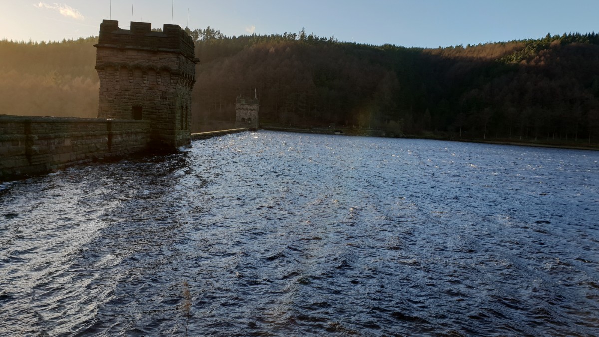
Derwent Dam
Edale
Current Weather
Last Updated today at : 20:59:52
| Overall : | scattered clouds |
| Temperature : | 22degC. |
| Wind Speed : | 16km/hr. |
| Wind Direction : | SW |
| Clouds : | scattered clouds |
| Precipitation : | none |
| Sunrise : | 03:40:52 |
| Sunset : | 20:39:30 |
| : | Times are GMT add 1 hour for BST |
Data from openweathermap.org
The Howden Moors are on the east of Derwent Reservoir. Once on the top these moors are extensive areas of "flat" moorland with views, on a good day, in all directions. This is a quiet area of the Peak District and on many days the walker will not see anyone until they get to the popular area of Back Tor and Lost Lad.
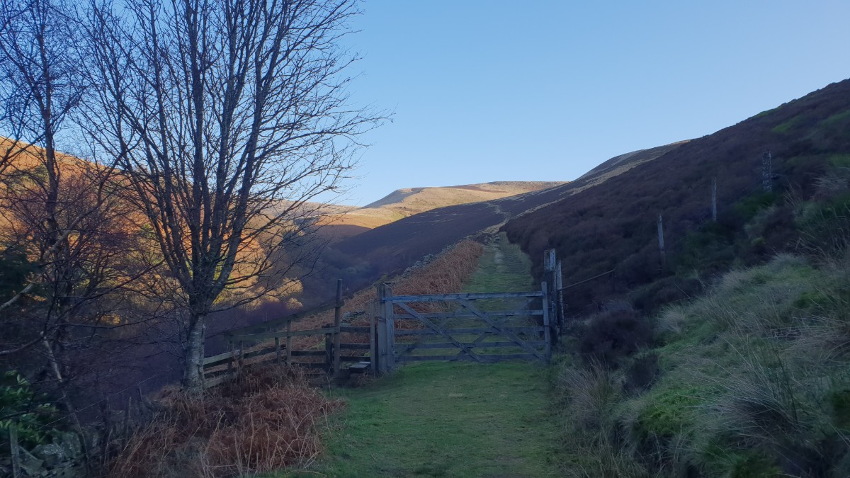
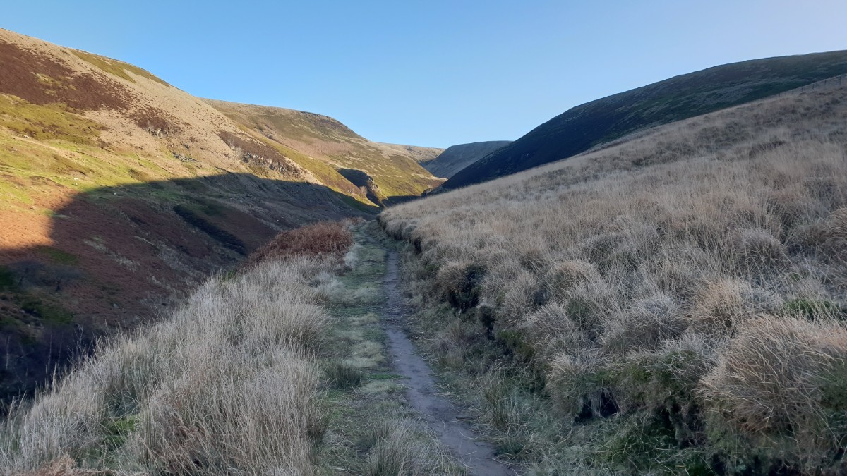
Leave Fairholms and follow the paths across the field infront of the Derwent Dam to the eastern corner. Ascend the steps here to reach the track that follows the eastern shore of Derwent reservoir. Follow this track for some 2km to reach the start of Abbey Brook. Just prior to a bridge there is a signposted route up the clough. Follow the track as it ascends to a gate and then onto the hillside. Just keep going until Sheepfold Clough is reached. Now cross the stream and follow the path along the direction of Abbey Brook. Just keep going as height is gained and the walker reaches the flat moorland that is Howden Moor. The path is well defined along Abbey Brook and does reach the significant path of Carteledge Stones Ridge. (7.0kms. 300m. 2hrs. 40min.)
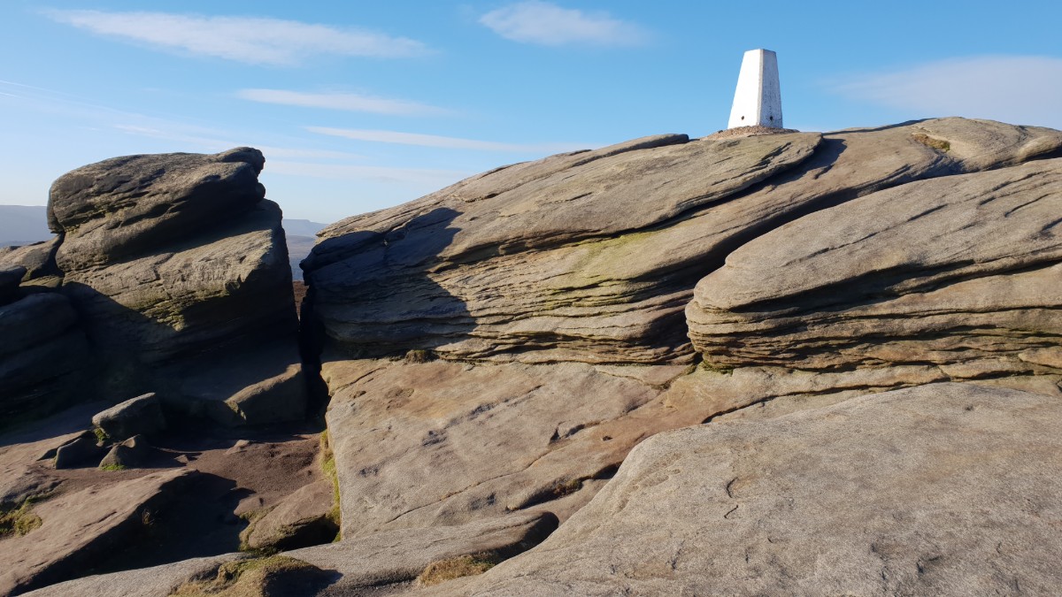
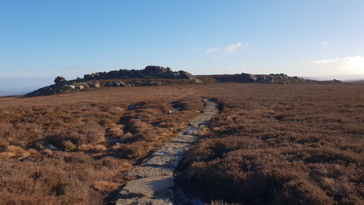
The views on the moor are extensive. Over much of South Yorkshire, down towards Chatsworth and over to Kinder. the route now goes south down Carteledge Stones Ridge to Back Tor. Much of this path is made up of solid limestone flag stones making walking easy. Back Tor is a distinctive top with the white trip point on top of the rocks. Great views again here. Follow the path down to Lost Lad and continue along the footpath around green Stiches and over to the wall. Cross the wall and follow the distinctive footpath initially north west then arond to the south west, descending all the time. Finally reach the east side of Derwent Reservoir. Retrace your steps back to Fairholms down the track and then paths under the dam wall. (7.0kms. 50m. 2hrs. 10min.)
8th January 2019 A cold clear day with near perfect blue skies. Fellow walkers alongside the reservoir and down from Back Tor but the main part of Abbey Brook and Howden Moors were empty. Cold.
 My Blog
© gritstoneedge.co.uk all rights reserved 2015-2026