
CORVID-19 Hill-walking is great exercise and it is good to get out in the outside world and it is inherently safer and healthier than staying indoors. But we still lneed to take precautions whilst outside. Please do not go out walking if you are showing sisns of Corvid-19. When out walking make sure you give people space - 1m at least and preferable 2m. Remember that if it feels too crowded then walk away and try somewhere else. If you get into difficulty the MRT will come out to help you but they should not have to put themselves into danger from this virus. Take Care Out There.
Mam Tor - The Great Ridge.
| OS Map : | 110 |
| Start : | Castleton Car Park |
| SK149830 | |
| 200 | |
| The main car park in Castleton. This can be full and is expensive. There are other places to park in Castleton. The walk starts from this car park. | |
| Summary : | Mam Tor - Spring House Farm - Lose Hill - Back Tor - Mam Tor - Cavedale - Castleton |
| distance : | 11.5km. |
| ascent : | 400m. |
| time : | 4hr. 10min. |
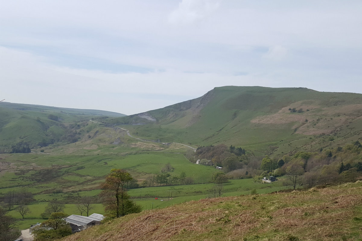
MamTor from Castleton Valley.

MamTor from Castleton Valley road.

Looking back to Back Tor and Lose Hill.

Back Tor.

Towards Mam Tor.

Looking up Cave Dale.
Edale
Current Weather
Last Updated today at : 20:58:10
| Overall : | scattered clouds |
| Temperature : | 22degC. |
| Wind Speed : | 16km/hr. |
| Wind Direction : | SW |
| Clouds : | scattered clouds |
| Precipitation : | none |
| Sunrise : | 03:40:52 |
| Sunset : | 20:39:30 |
| : | Times are GMT add 1 hour for BST |
Data from openweathermap.org
"The Great Ridge" is a name given to the Lose Hill, Back Tor, Mam Tor ridge that dominates the westerly part of the Hope Valley. This route climbs the ridge at the eastern edge and follows around the Castleton skyline going initially to Mam Tor and then down into Limestone country, through the fields, and finally down Cave Dale back to Castleton itself.
Start at Castleton. Exit the car park and follow the main road east around one severe left hand bend until the next bend when thankfully the walker can go straight ahead to the quieter environs of Hollowfield Road. Follow this road until the footpath on the right at the Training Centre. Continue past Lose Hill Hall and onto Spring House Farm. From here take the signposted route directly up Lose Hill. The path goes near to but not quite up to Lose Hill Farm and then directly up to the summit of Lose Hill. (3kms. 300m. 1hrs. 30min.)
Walk along the length of the Great Ridge. From Lose Hill the full extent of the ridge is in view with a good wide path. Descend from Lose Hill and then reascend Back Tor. Down again from Back Tor to Hollins Cross. Make sure you turn around to see Back Tor as the most impressive side is from the west. Hollins Cross is the pass between Castleton and Edale and very busy. Marked with a direction dial. From here the path ascends Mam Tor and again it is good wide and busy. Indeed Mam Tor summit with it's trig pont is one of the most busy places in the Peak District. (3.5kms. 100m. 1hrs. 20min.)
The route now goes into White Peak area. Descend Mam Tor by the obvious path and at the road, turn right and through the gate. Descend through the field to meet the Winnats Path road. Cross this road and through the date to the track going to Rowter Farm. Follow this well made track until SK135813. At this crossroads turn left, east, and follow the path towards Cave Dale, part of the Limestone Way. The path follows fields and then descends into Cave Dale itself. It is very tight in a number of places. The sides of the dale have some interesting features, holes, in the limestone rock. At the bottom is a gate that leads to Castleton. Follow through the streets to reach the car park. The lower slopes of Cave Dale are often wet even after a long dry spell. (5kms. 0m. 1hrs. 30min.)
3rd January 2020 Mam Tor is one of the most popular hills in the Peak District and today was no different despite the cold damp and wind later on. Very slippy underfoot; do they make special mud here? Decided against Cavedale as this is slippy at the best of times and it would be treacherous today. Walked down the old road. Surprising how much it has slipped since the closure in 1979.
 My Blog
© gritstoneedge.co.uk all rights reserved 2015-2026