
CORVID-19 Hill-walking is great exercise and it is good to get out in the outside world and it is inherently safer and healthier than staying indoors. But we still lneed to take precautions whilst outside. Please do not go out walking if you are showing sisns of Corvid-19. When out walking make sure you give people space - 1m at least and preferable 2m. Remember that if it feels too crowded then walk away and try somewhere else. If you get into difficulty the MRT will come out to help you but they should not have to put themselves into danger from this virus. Take Care Out There.
High Stones.
| OS Map : | 110 |
| Start : | Kings Tree |
| SK169950 | |
| 270 | |
| There is limited car parking at the end of the road on the side of Howden reservoir. The road from Fairholms, at the end of Ladybower Reservoir, is closed on Saturdays, Sundays and Public Holidays. So this is a walk for midweek. An alternative is to take the bus from Fairholms. | |
| Summary : | Kings Tree - Slippery Stones - Nether Hey - High Stones - Margery Hill - Cut Gate - Slippery Stones - Kings Tree |
| distance : | 12.5km. |
| ascent : | 330m. |
| time : | 4hr. 20min. |


Edale
Current Weather
Last Updated today at : 19:40:47
| Overall : | broken clouds |
| Temperature : | 23degC. |
| Wind Speed : | 16km/hr. |
| Wind Direction : | SSW |
| Clouds : | broken clouds |
| Precipitation : | none |
| Sunrise : | 03:40:52 |
| Sunset : | 20:39:30 |
| : | Times are GMT add 1 hour for BST |
Data from openweathermap.org
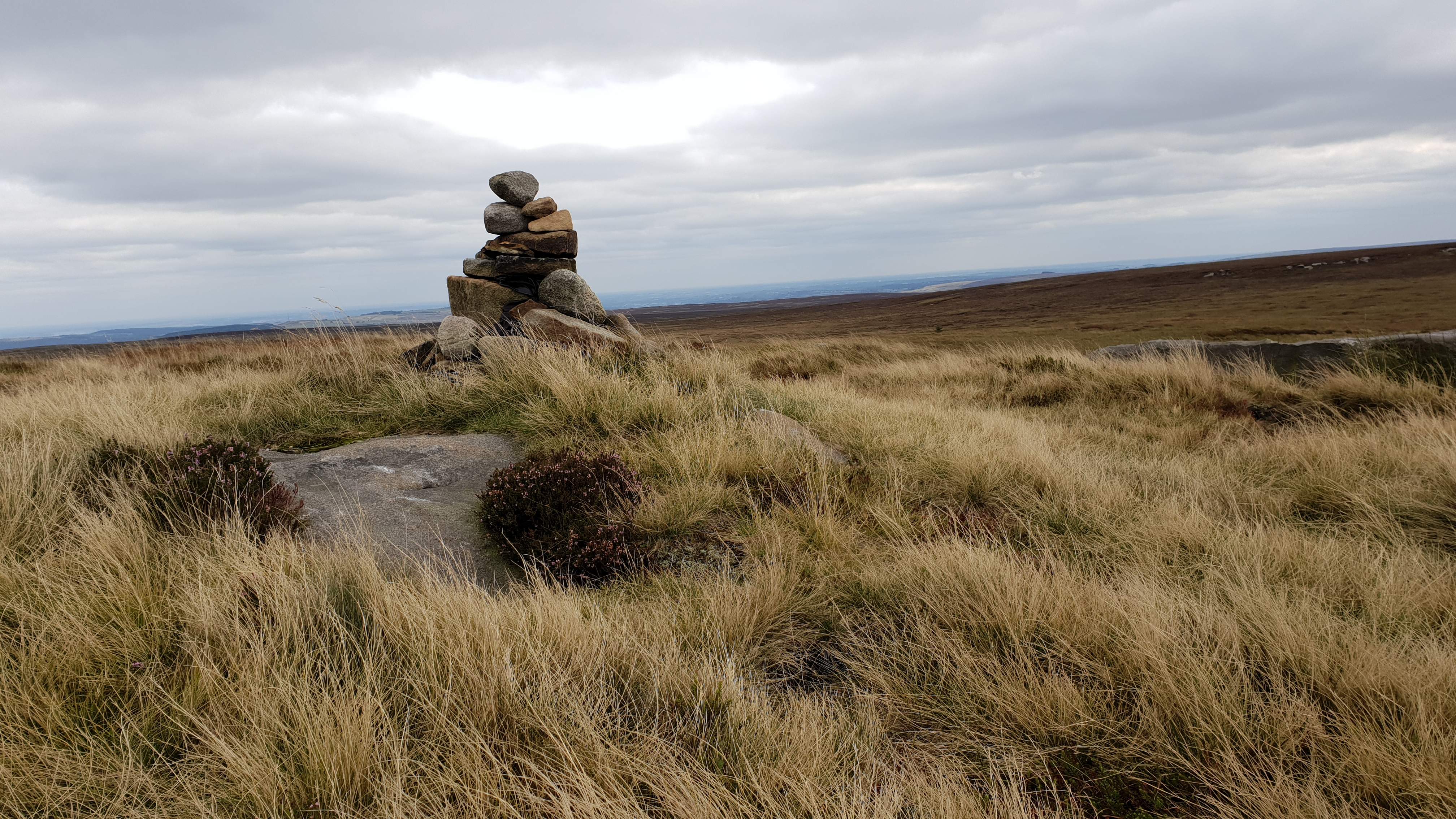
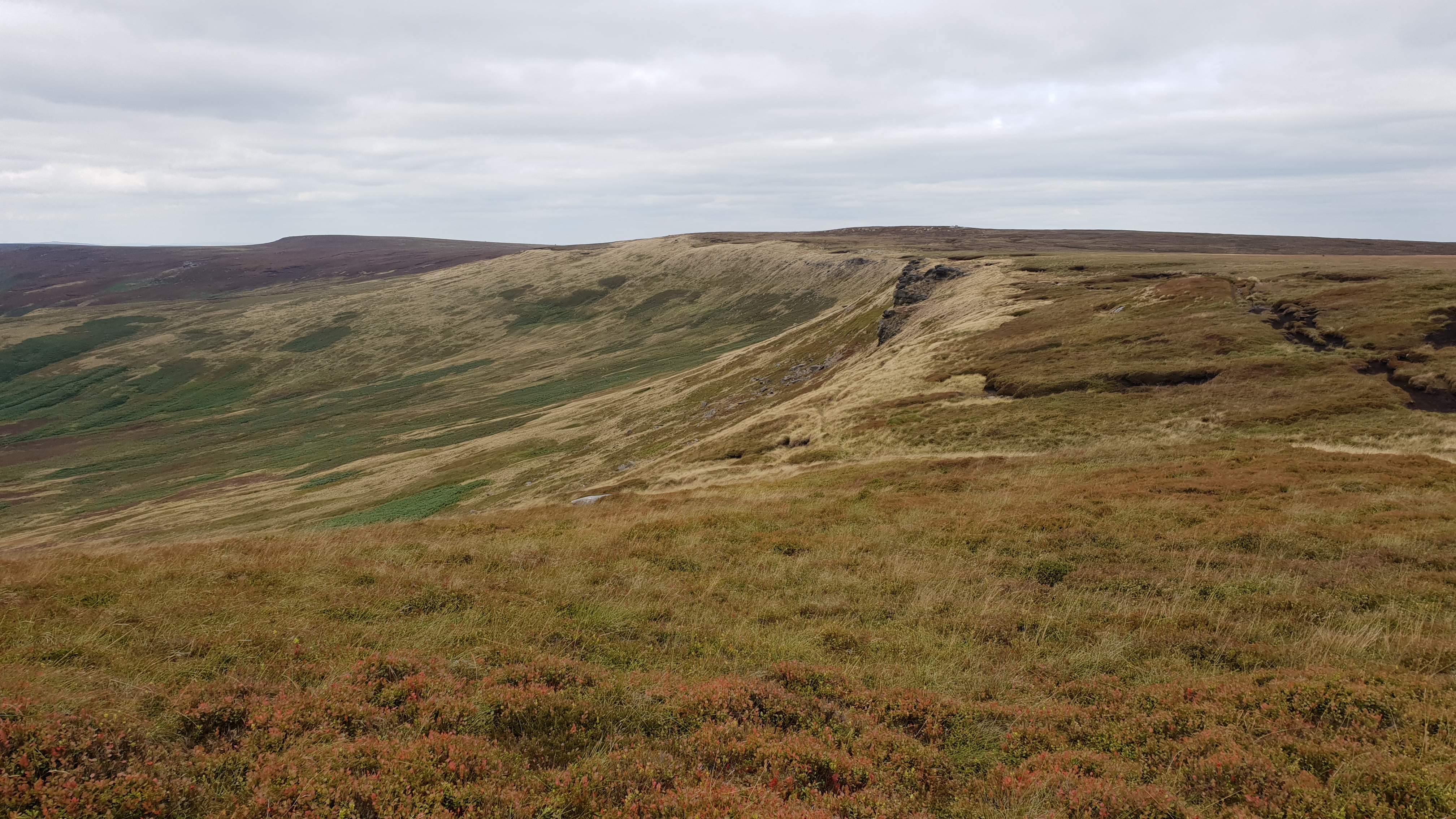
This is the highest point in Sheffield, and indeed South Yorkshire. High Stones is the high point of Howden Edge. This is a remote moor but there are excellent paths to the summit. The high moor between High Stones and Margery Hill to the north and especially to Back Tor to the south can be very wet but the paths chosen for this route avoid he worst of the bogs. The hill gives great views over Bleaklow and Kinder and east over most of South Yorkshire and beyond.
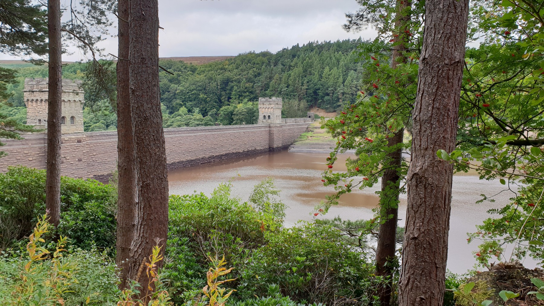
From Kings Tree, walk through the gate and then 2km up the track to reach the bridge over the river. Cross this and continue another 100m to reach the path that takes the east side if the reservoir. Follow this track around Howden reservoir to the dam. Just past this is a track heading north east and uphill. (SK171922). Follow this grassy track up through the trees and onto the open moor. The track skirts around the summit of Nether Hey before descending slightly. Continue to follow the track up the hillside all the way to High Stones. The summit is marked by a pile of stones. From here there are good views of Kinder, Bleaklow and over much of South Yorkshire. (7.5kms. 280m. 2hrs. 50min.)
From the summit there is a path around the edge, variously called Howden Edge and Wilfrey Edge. After a short descent a fence is reached. Turn right, east, and follow the fence line to the trig marking the summit of Margery Hill. There is a distinct but maybe wet path north from Margery Hill to the Cut Gate path. Follow this path as best you can. The Cut Gate path is well define, and rocky. Follow this path west to descend to the Upper Derwent Valley. Once at the main track turn left, south to cross the river again at Slippery stones and then retrace your steps along the track to Kings Tree, (5.0kms. 50m. 1hrs. 40min.)
28th August 2018 Maybe not a sunny day, overcast, but the walk was undertaken at the end of summer 2018 in which the sun had dried out the wet moorland. At the time of the walk the reservoirs were meant to be 46% full, but Howden and Derwent looked very empty. Often on walks like this nobody is seen but perhaps because this was just after the Bank Holiday there was a few people out on High Stones. A good walk not least because of the dry conditions and the paths throughout.
22nd July 2019 Another visit to High Stones, and this time in the heat of summer. Again there was nobody about despite this being the start of the school holidays. This is a place to get away from it all. The paths chosen on this walk were dry, this is despite a thunderstorm the hight before. A great walk away and somewhere to be by yourself.
 My Blog
© gritstoneedge.co.uk all rights reserved 2015-2026