Edale Skyline

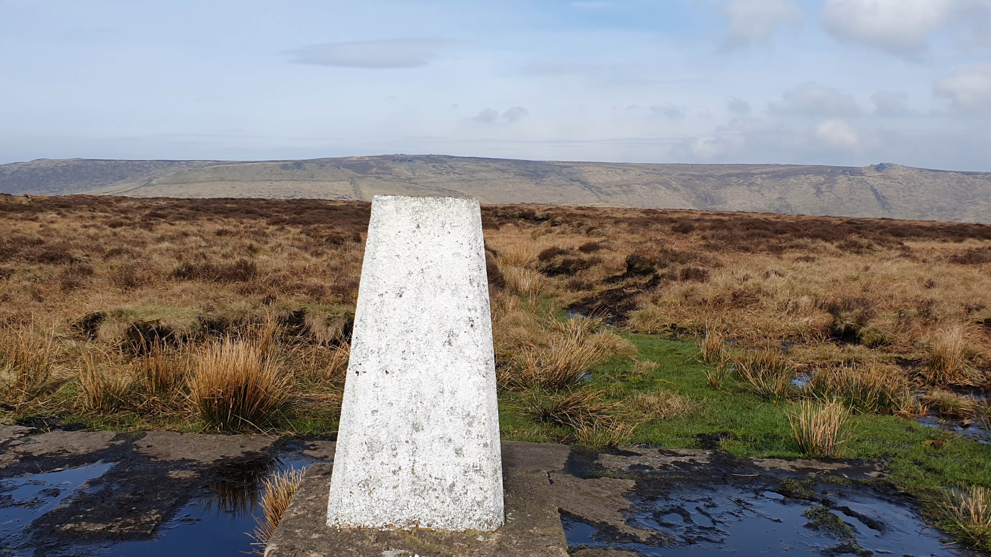
Win Hill Trig Point and Kinder beyond.
©gritstoneedge.co.uk
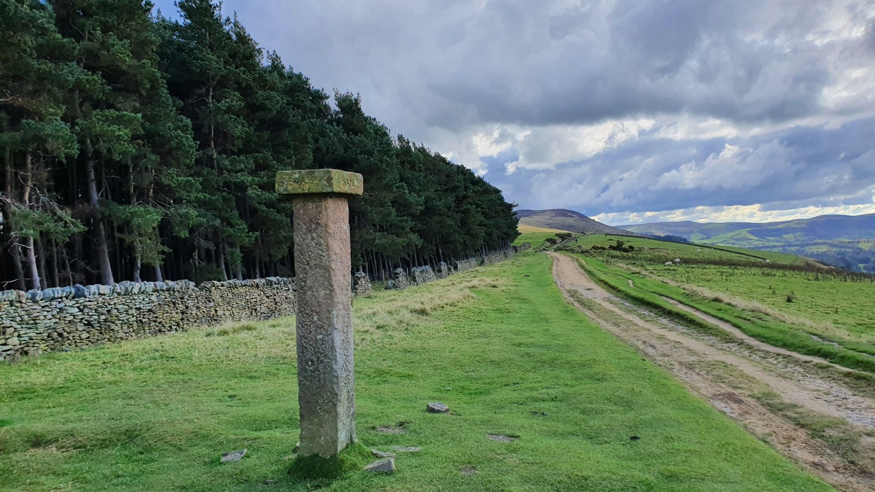
Hope Cross and Up to Win Hill.
©gritstoneedge.co.uk

trig point at .590
©gritstoneedge.co.uk
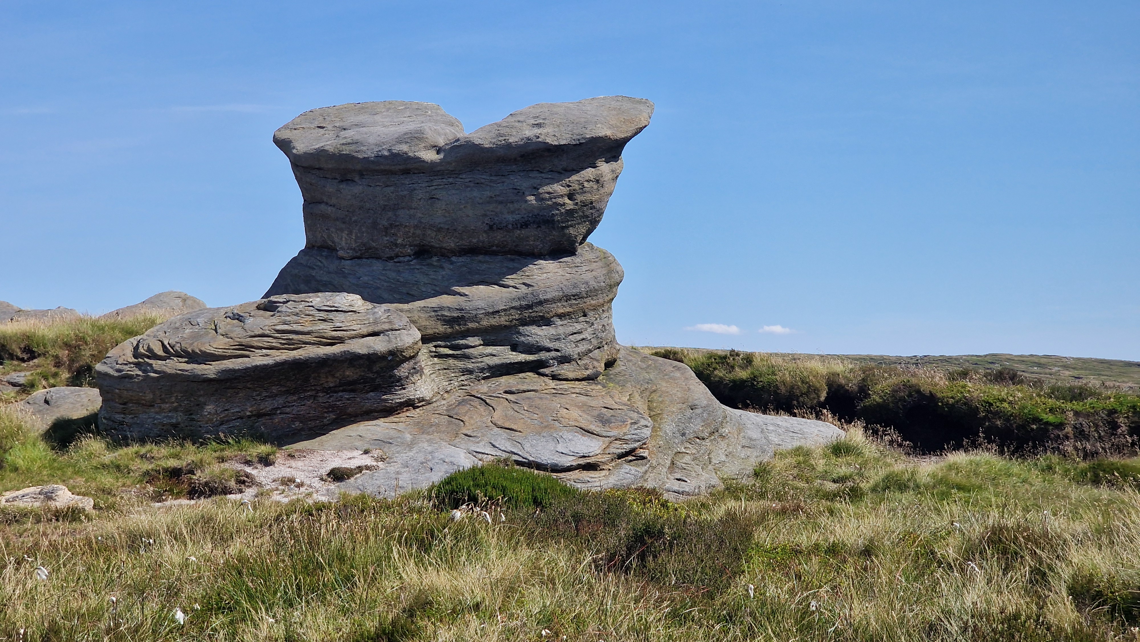
Pym's Chair
©gritstoneedge.co.uk
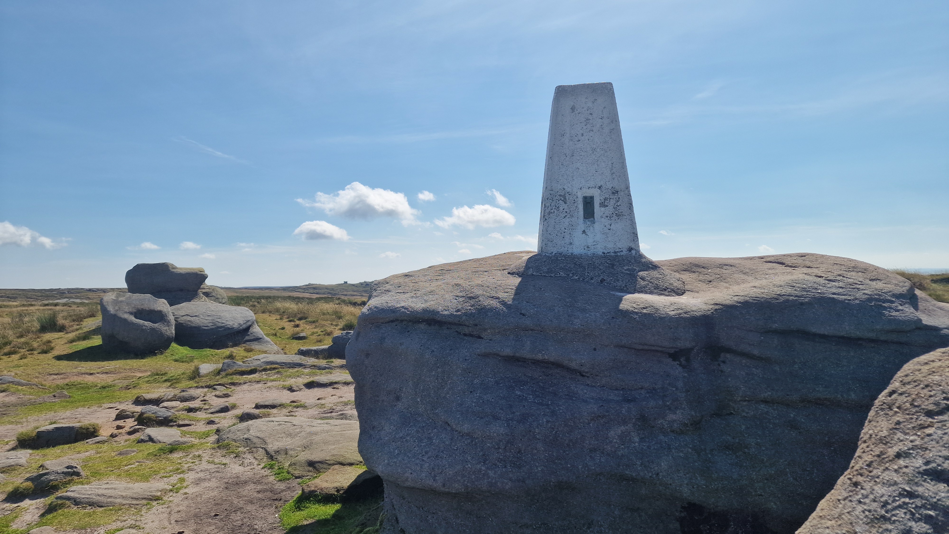
Trig point at Kinder Low
©gritstoneedge.co.uk
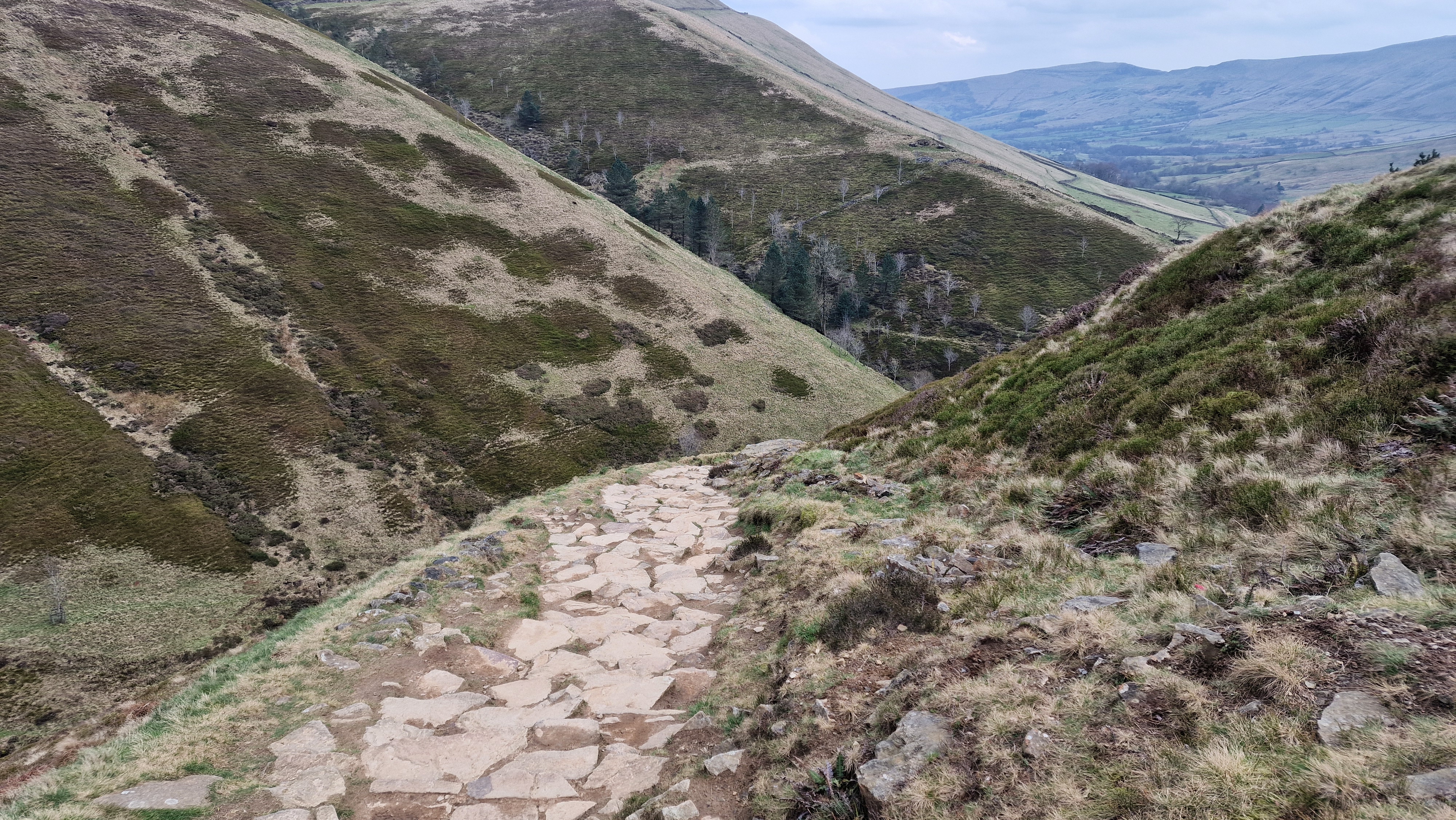
Looking down Jacobs Ladder.
©gritstoneedge.co.uk
Brown Knoll Trig Point.
©gritstoneedge.co.uk

Lords Seat from Brown Knoll
©gritstoneedge.co.uk

Looking towards Mam Tor.
©gritstoneedge.co.uk
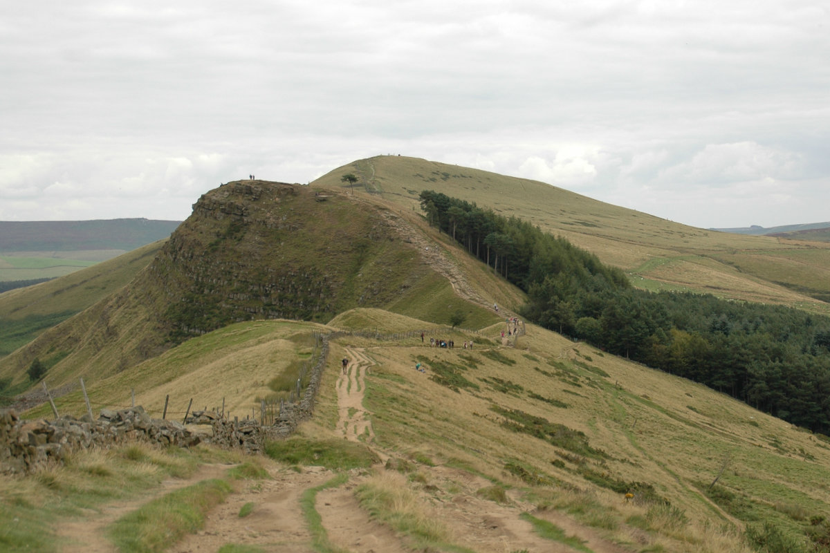
Looking towards Back Tor and Lose Hill.
©gritstoneedge.co.uk
| Hill Summit : | Win Hill[SK186850, 462m.] |
| Hill Summit : | Kinder Low[SK079870, 633m.] |
| Hill Summit : | Brown Knoll[SK083851, 568m.] |
| Hill Summit : | Mam Tor[SK127836, 517m.] |
| Hill Summit : | Lose Hill[SK153853, 476m.] |
| Start : | Hope Village A pay car park in Hope Village just west of the Church.[SK169834 160m ] |
| Summary : | Hope - Win Hill - Hope Cross - Crookstone Knoll - Crowden Tower - Brown Knoll - Rushop Edge - Mam Tor - Lose Hill - Hope |
| distance : | 27.5km. |
| ascent : | 760m. |
| time : | 9hr. 30min. |
Edale Skyline has been a walking challenge for many over the years. There is no definitive route other than going around the Edale Valley on the skyline. This walk takes a traditional route around the valley skyline but does not start at Edale itself - a start at Hope is much more logical. The route takes in all the well known features in the area. Although a long walk and a challenge, pick a good day for weather and it is a great experience. The views over much of the northern part of the Peak District are worth the effort.
edale
Current Weather
Last Updated today at : 08:47:24
| Overall : | broken clouds |
| Temperature : | 10degC. |
| Wind Speed : | 23km/hr. |
| Wind Direction : | ENE |
| Clouds : | broken clouds |
| Precipitation : | none |
| Sunrise : | 05:35:35 |
| Sunset : | 18:45:05 |
| : | Times are GMT add 1 hour for BST |
Data from openweathermap.org
Leave Hope on the minor road going to Edale. After some 200m take the turning right that goes under the railway. This is the footpath to Win Hill. It is well marked as the track first goes past first Twitchill Farm and the path climbs towards Win Hill. Once the height has been climbed the path goes east to reach Win Hill trig point and summit. Win Hill is noted for the views especially up the Derwent Valley. (2.0kms. 300m. 1hrs. 20min.)
The route takes the path, north east, along the ridge. Once down from the summit there is a forest on the right with extensive views down the Edale Valley on the left. This gives a view all around the route here. The path is good, albeit quite eroded. At the low point of the ridge, by a wall and path junction is Hope Cross. From here the route climbs to Crookstone Barn. From here it is up Crookstone Hill to reach Crookstone Knoll at the far eastern point of Kinder. (5.0kms. 140m. 1hrs. 50min.)
Crookstone Knoll is the eastern most point on the south edge of Kinder. This section is to walk along the full length of the southern edge of Kinder. There is a path all the way. This first section is much less busy than the western part. Follow the path, passing Ringing Rodger, Nether Tor, the top of Grindsbrook and onto Crowden Tower at the top of Crowden Brook and then Pym's Chair and Noe Stool. For a full round of Edale Skyline, Kinder Low should be included. The easiest walking is to follow the path around the edge as it descends and then a path joins on the right, follow this path to Kinder Low summit. As this sits on the west of Kinder there are good view down to Glossop and Manchester beyond. (7.0kms. 100m. 2hrs. 20min.)
Leave Kinder Low in a southerly direction past Swines Back and then onto the top of Jacobs Ladder. This section is on the Pennine Way and Jacobs Ladder marks the top of the climb out of Edale Valley. Continue south climbing to the wall, and then along the good path to get to the summit of Brown Knoll. the summit is marked with a trig point. (2.0kms. 50m. 0hrs. 50min.)
Now we start the southern part of this walk around the Edale Valley. The geology changes here, Rather than the gritstone rocks formations that mark the edge of Kinder, we are moving into areas of shale, Mam Tor and Back Tor being notable examples. Follow the path from Brown Knoll over the flag stones over the moor to reach the wall coming down from Rushop Edge. In the process the route crosses the Edale to Chinley railway line deep below our feet. Folow the path alongside the wall to reach the height of Rushop Edge and Lords Seat. Then the route descends to Mam Nic, the minor road pass. (5.5kms. 70m. 1hrs. 50min.)
Climb up from Mam Nic to the top of Mam Tor. This is a very popular path with Mam Tor is one of the most popular spots in the peak District and indeed the UK countryside. The final part of the route is along the Great Ridge. Continue downhill onto Hollins Cross making the low point between Mam Tor and Back Tor. Climb up to Back Tor by the good path. then follow the ridge line to reach the d=final summit at Lose Hill. Then descend Lose Hill by the good footpaths in a southerly direction to get back to Hop and the car park. (6.0kms. 100m. 2hrs. 0min.)
Use this link to view all the external gritstoneedge.co.uk resources.
 gritstoneedge linktr.ee
w : https://www.gritstoneedge.co.uk
e :
 gritstoneedge Blog
 gritstoneedge instagram
 gritstoneedge YouTube channel
 gritstoneedge Podcast
Disclaimer :This site has links to many adventures in the outdoors, walking or cycling in hills and moors, within the UK. These can be dangerous activities. Conditions can change rapidly in the outdoors. The information and links provided on this site is given in good faith. gritstoneedge.co.uk cannot be held responsible for any loss or injury caused by encouraging you into the outdoors of by the accuracy of the information provided on this site.
© gritstoneedge.co.uk all rights reserved 2015-2025