Howden Edge and Horse Stone

Walking up the River Derwent
©gritstoneedge.co.uk
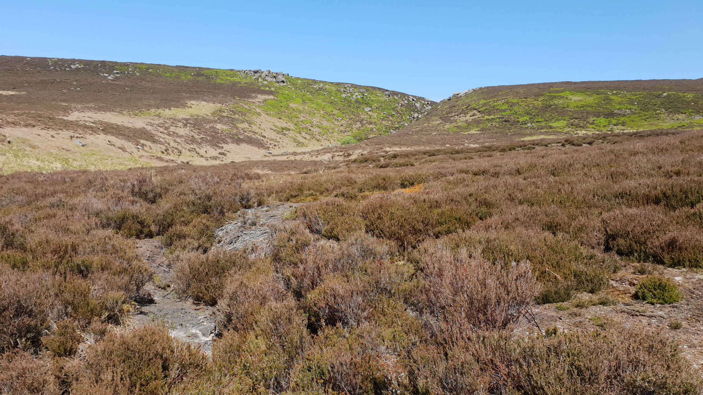
View up Hoar Clough
©gritstoneedge.co.uk

View down the Derwent Valley
©gritstoneedge.co.uk

Hoar Stones
©gritstoneedge.co.uk

Horse Stone
©gritstoneedge.co.uk
| Start : | Kings Tree Parking at the end of the Upper Derwent Valley road.[SK169950 270m ] |
| Summary : | Kings Tree - Hoar Clough - Featherbed Moss - Howden Edge - Horse Stone - Kings Tree. |
| distance : | 12.0km. |
| ascent : | 260m. |
| time : | 4hr. 0min. |
The Derwent Valley splits Bleaklow between the large plateau to the west and the edges to the east. This walk goes up the pleasant Derwent Valley and then onto the eastern edges with their extensive views over South Yorkshire and beyond. A great area to get away from it all in this popular part of the country.
Sheffield
Current Weather
Last Updated today at : 08:43:32
| Overall : | overcast clouds |
| Temperature : | 10degC. |
| Wind Speed : | 17km/hr. |
| Wind Direction : | NE |
| Clouds : | overcast clouds |
| Precipitation : | none |
| Sunrise : | 05:34:10 |
| Sunset : | 18:43:42 |
| : | Times are GMT add 1 hour for BST |
Data from openweathermap.org
Go through the gate and follow the path to Slippery Slopes, and over the River Derwent via the Pack Horse Bridge. From here the route follows the track along the Derwent valley. Just past Stannery Clough the track becomes a path but still follow this to Hoar Clough. Follow the path up Hoar Clough, up the true left bank towards the ridge. Shepherds Meeting Point is an intersting set of rocks seen on the opposite bank on the ascent. As the clough flattens out the path crosses the river and makes for the ridge of Featherbed Moss. In fact there are many paths here and also the upper part of Hoar Clough has some very deep groughs. This is a remote part of the Peak District but the most striking part of the view is over to the Woodhead Pass and Barnsley. Looking over to the Woodhead Pass it is clear why this suffers from snow closures in winter. The ridge over Featherbed Moss is often wet; the name gives it away. However there has been a lot of conservation work taking place in an attempt to reduce the erosion in the area. The results have been positive and the area is not as wet as it has been in the past. The route keeps as much as possible to the boundary line, the high ground over to Howden Edge. Hoar Stones are set just below the ridge and worth a visit on the way. A detour to Hoar Stone should be from the ridge and back, any contemplation of cutting corners here will end in large groughs. (7.5kms. 210m. 2hrs. 40min.)
Don't be conned to make directly to Horse Stone, there are a number of very deep and wet groughs to cross. From Howden Edge continue along the ridge to SK158983. From here it is an easier approach to the rounded hill of Horse Stone. The rocks around this part of the Peak District are most interesting so take in the view from Bleaklow Stones around to Crow Stones Edge. To descend follow Horse Naze downhill, keeping the rocks to your right. Follow the ridge down steeply and largely pathless but there are some sheep tracks. Aim for where Lower Stainery Clough meets the wood at the wall. Now walk around the wall to join Stainery Clough and then onto reach the Derwent track at the bottom of the clough. Follow the valley back down to Kings Tree. When walking up the valley the land closes in, moving to a wilder environment; the way back opens out giving a more expansive view down the Derwent Valley. (4.5kms. 50m. 1hrs. 30min.)
1st May 2019 Followed the route out as described here. There has been a fair amount of rain recently but the ridge was not seriously wet. Rather than cut down to Horse Stone, I followed the ridge the full length to Outer Edge and then onto Cut Gate. From here I descended to the valley bottom. An interesting variation of this walk. There are reasonable paths all along the ridge much improved with the conservation work of damming the groughs and installing hessian sacks along the path. Apart from around the honey-pot of Kings Tree I saw no other walkers which was surprising as this was a nice spring may Day.
22nd May 2018 In an attempt to get a dry experience with this route, I attempted it after a prolonged dry period. Underfood was not wet at all which was great. On the top ridge, Featherbed Moss to Howden Edge, work has been carried out to stop the erosion and to dry out some of the areas. Once away from the main track / path along the River Derwent there are few paths. I followed the small sheep tracks which are often better than those marked on the OS maps. A great walk in the sunshine.
Use this link to view all the external gritstoneedge.co.uk resources.
 gritstoneedge linktr.ee
w : https://www.gritstoneedge.co.uk
e :
 gritstoneedge Blog
 gritstoneedge instagram
 gritstoneedge YouTube channel
 gritstoneedge Podcast
Disclaimer :This site has links to many adventures in the outdoors, walking or cycling in hills and moors, within the UK. These can be dangerous activities. Conditions can change rapidly in the outdoors. The information and links provided on this site is given in good faith. gritstoneedge.co.uk cannot be held responsible for any loss or injury caused by encouraging you into the outdoors of by the accuracy of the information provided on this site.
© gritstoneedge.co.uk all rights reserved 2015-2025