Kinder - Northern Edges
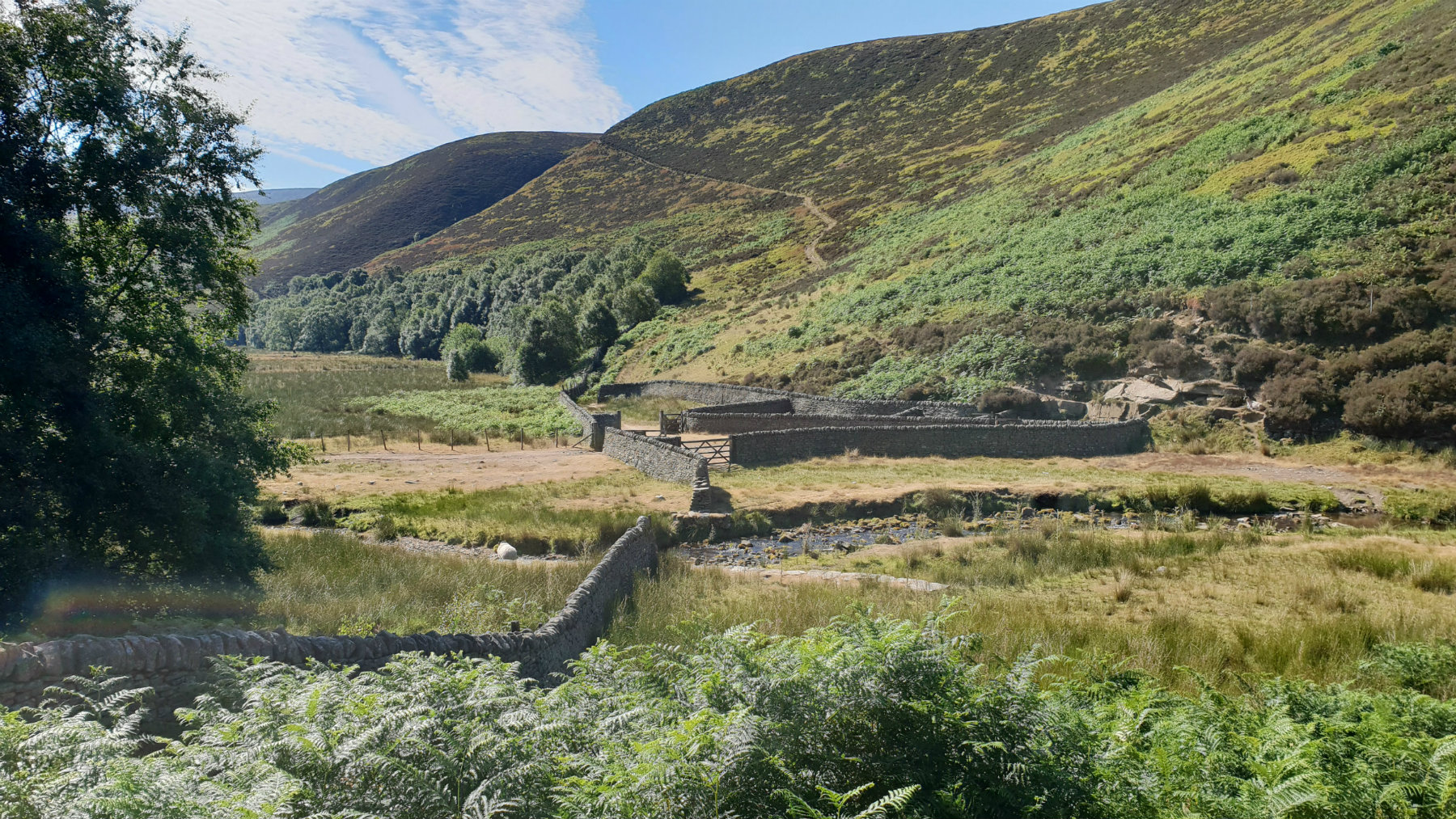
Bottom of Fair Brook
©gritstoneedge.co.uk

Path up to the edge
©gritstoneedge.co.uk

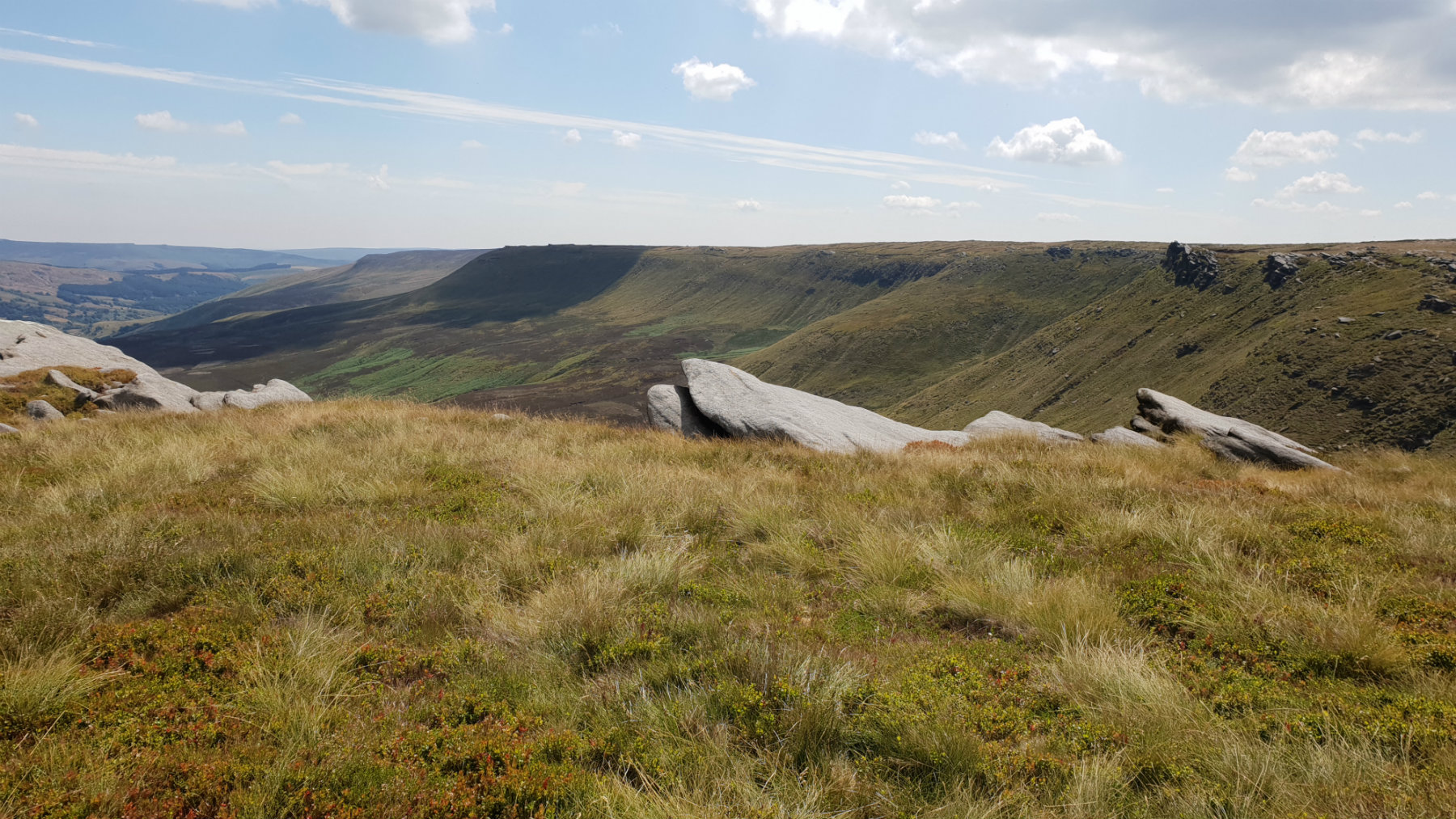
Fairbrook Naze with Bleaklow behind
©gritstoneedge.co.uk
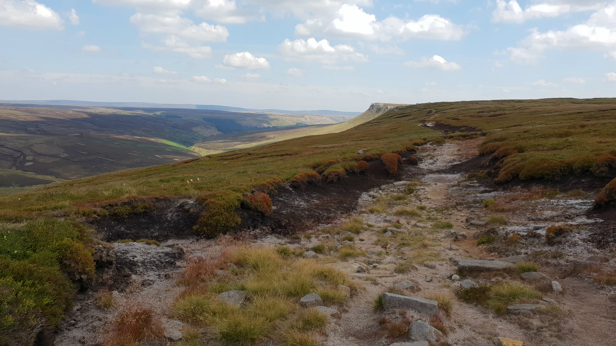
View back along edge
©gritstoneedge.co.uk
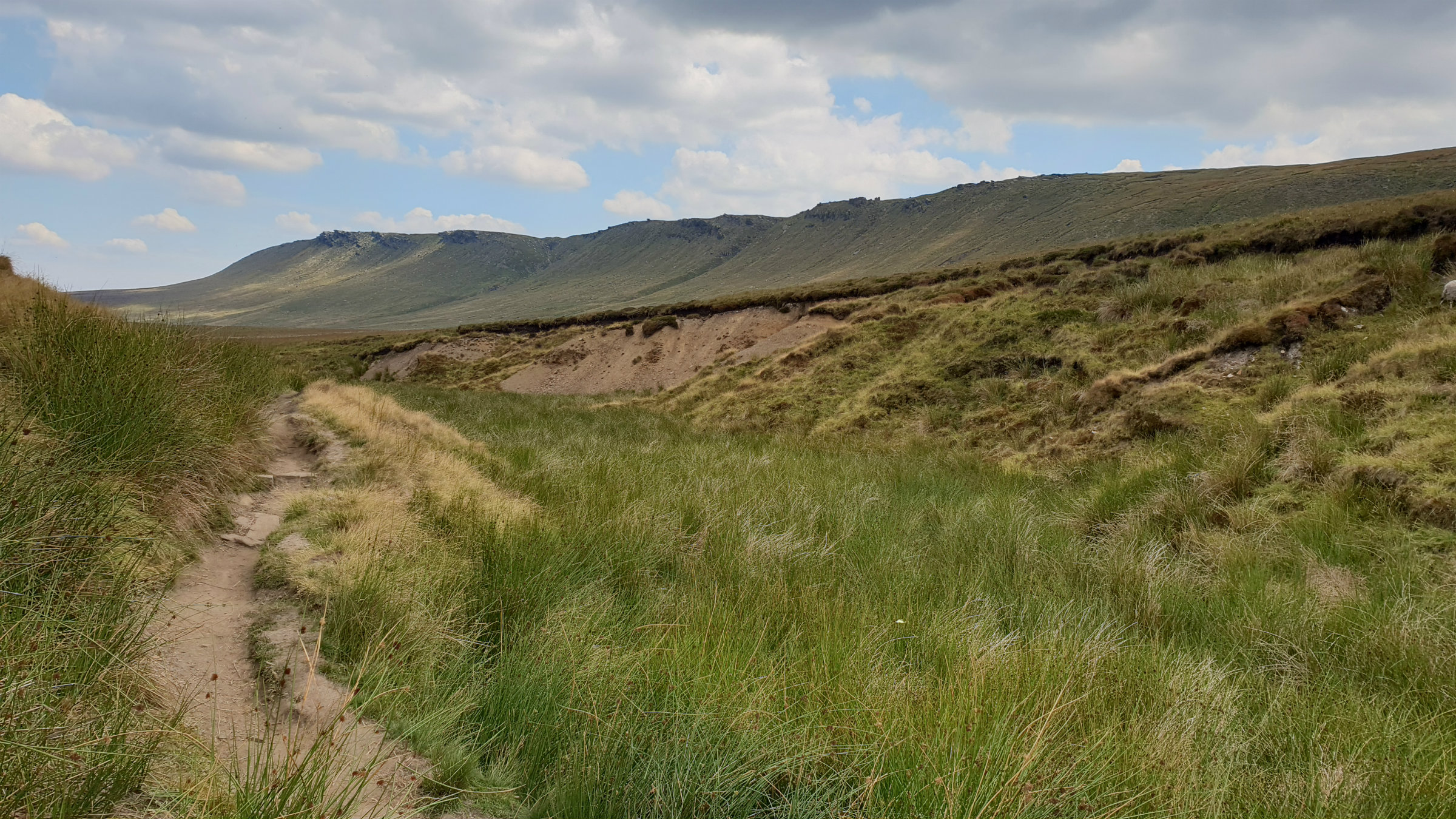
Path along the edge
©gritstoneedge.co.uk
Edge from Snake Path
©gritstoneedge.co.uk
| Start : | Birch Clough Bridge. The significant layby on this corner of the A57. Can become quite busy due to the lack of parking along this road. [SK109914 362m ] |
| Summary : | Birch Clough - Seal Stones - Seal Edge - The Edge - Ashop Head - Snake Path - Birch Clough |
| distance : | 16.0km. |
| ascent : | 490m. |
| time : | 5hr. 40min. |
Kinder is a large flat plateau surrounded by steep edges. This walk follows the edges along the north of Kinder. These rock edges here, mark the northern limit of Kinder and create an edge with a significant drop. From here views north towards Bleaklow are extensive on days of good visibility. The return is a lovely walk down the snake path alongside Ashop Clough.
Edale
Current Weather
Last Updated today at : 08:51:37
| Overall : | broken clouds |
| Temperature : | 10degC. |
| Wind Speed : | 23km/hr. |
| Wind Direction : | ENE |
| Clouds : | broken clouds |
| Precipitation : | none |
| Sunrise : | 05:35:35 |
| Sunset : | 18:45:05 |
| : | Times are GMT add 1 hour for BST |
Data from openweathermap.org
From the parking cross the road and head through the forest. There is a good footpath, getting better all the time as more and more people use it, that goes due south through the forest. Towards the southern end of the forest is a footbridge. To avoid walking along the busy A57 you must cross the River Ashop, and options are limited. Follow the path, right, that walks up the Ashop Valley for 2km where there is a bridge over the river at a small building. Cross the river and walk back down the valley on the other side on a smaller path higher up the valley sides. Opposite the first footbridge the path turns right and down the Woodlands Valley. Follow this path around to Fair Brook. Cross this on the stepping stones and then through the sheep pens, follow the good path which climbs the hillside steeply to get around to Gate Side Clough. There is a path up this clough. From around halfway follow the wall. This path is the major climb of the day and reaches the edge at Seal Stones. (6.0kms. 400mm. 2hrs. 40min.)
There is a well defined path around the edge which is followed all the way around the edge. There can be some wet bits especially around the top of Upper and Middle Seal Clough. Make to the Fords at the top of Fair Brook and then turn northerly to make for the top of Fairbrook Naze. There is a more direct path that climbs up Fairbrook Naze to this point which avoids Seal edge if you wish a shorter route. (2.0kms. 40m. 0hrs. 40min.)
The edge becomes more like an edge from here, with a more distinctive rocky edge. Walk along The Edge for 2km until the edge becomes more indistinct, but the path continues onto reach the Pennine Way. At the col before Mill Hill there is a distinct crossing. This route turns right, east, to follow the Snake Path. This is a good path. Look out for the ruined building at around half way. The path enters a forest about 1km from the road. Follow the path through the forest to get to the footbridge. Once overr the footbridge turn left and follow the path north; this is the path followed the other direction at the start of the walk. The path leads to the A57, cross the road to the car. (8.0kms. 50m. 2hrs. 30min.)
11th July 2018 I did this walk in mid July 2019, after an incredibly long dry spell so the wetness of the paths were not a concern. Indeed the peat was baked dry and there was a high fire risk in the Peak District. Major environmental improvements are taking place on Kinder and there is a fence around the plateau, with stiles at path crossings, to keep the sheep out. Despite this I saw two stray ewes the wrong side of the fence; report to the authurities
Use this link to view all the external gritstoneedge.co.uk resources.
 gritstoneedge linktr.ee
w : https://www.gritstoneedge.co.uk
e :
 gritstoneedge Blog
 gritstoneedge instagram
 gritstoneedge YouTube channel
 gritstoneedge Podcast
Disclaimer :This site has links to many adventures in the outdoors, walking or cycling in hills and moors, within the UK. These can be dangerous activities. Conditions can change rapidly in the outdoors. The information and links provided on this site is given in good faith. gritstoneedge.co.uk cannot be held responsible for any loss or injury caused by encouraging you into the outdoors of by the accuracy of the information provided on this site.
© gritstoneedge.co.uk all rights reserved 2015-2025