Bleaklow Summits from Pennine Way

Route up Doctors Gate
©gritstoneedge.co.uk
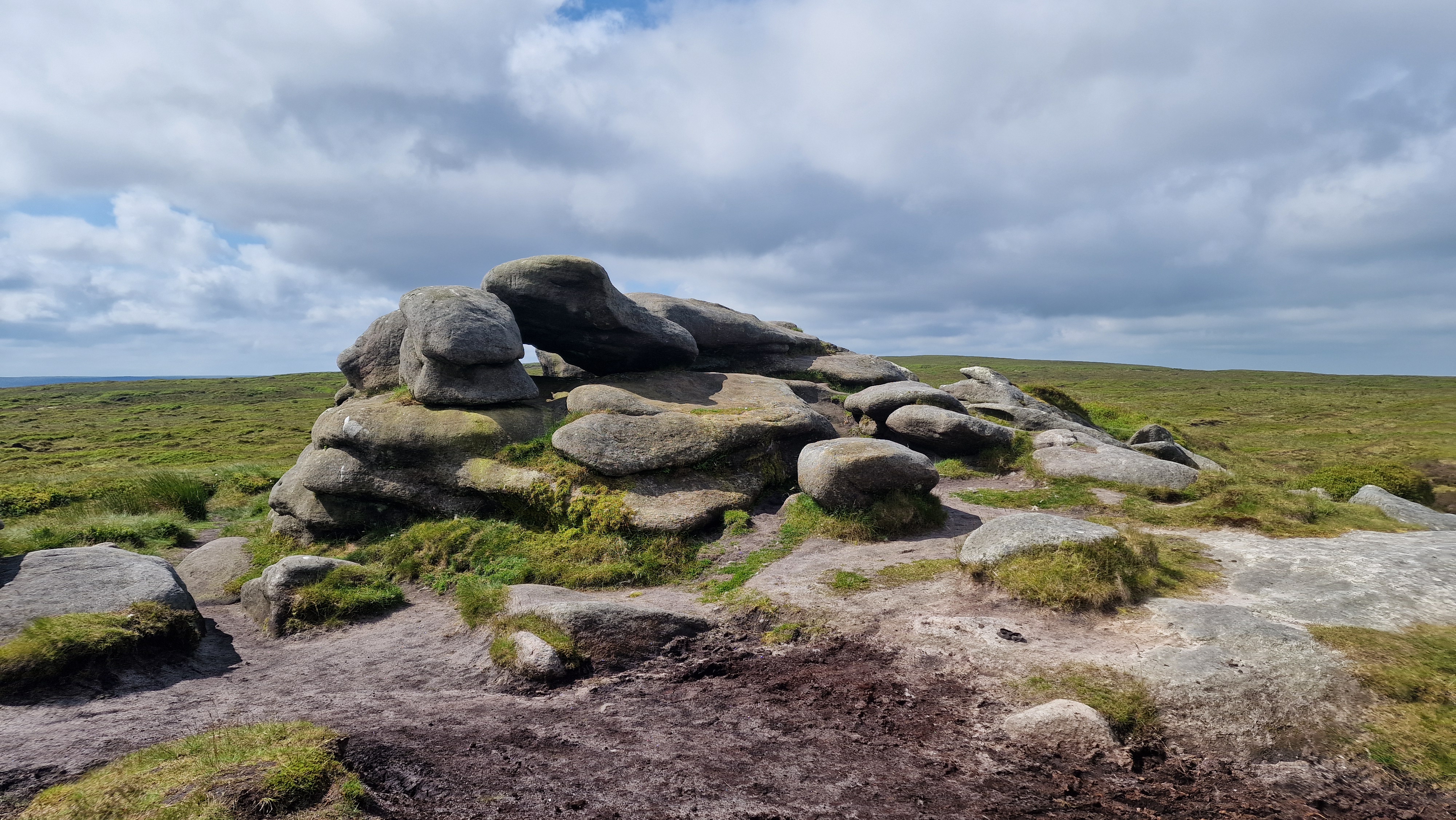
Hern Stones.
©gritstoneedge.co.uk
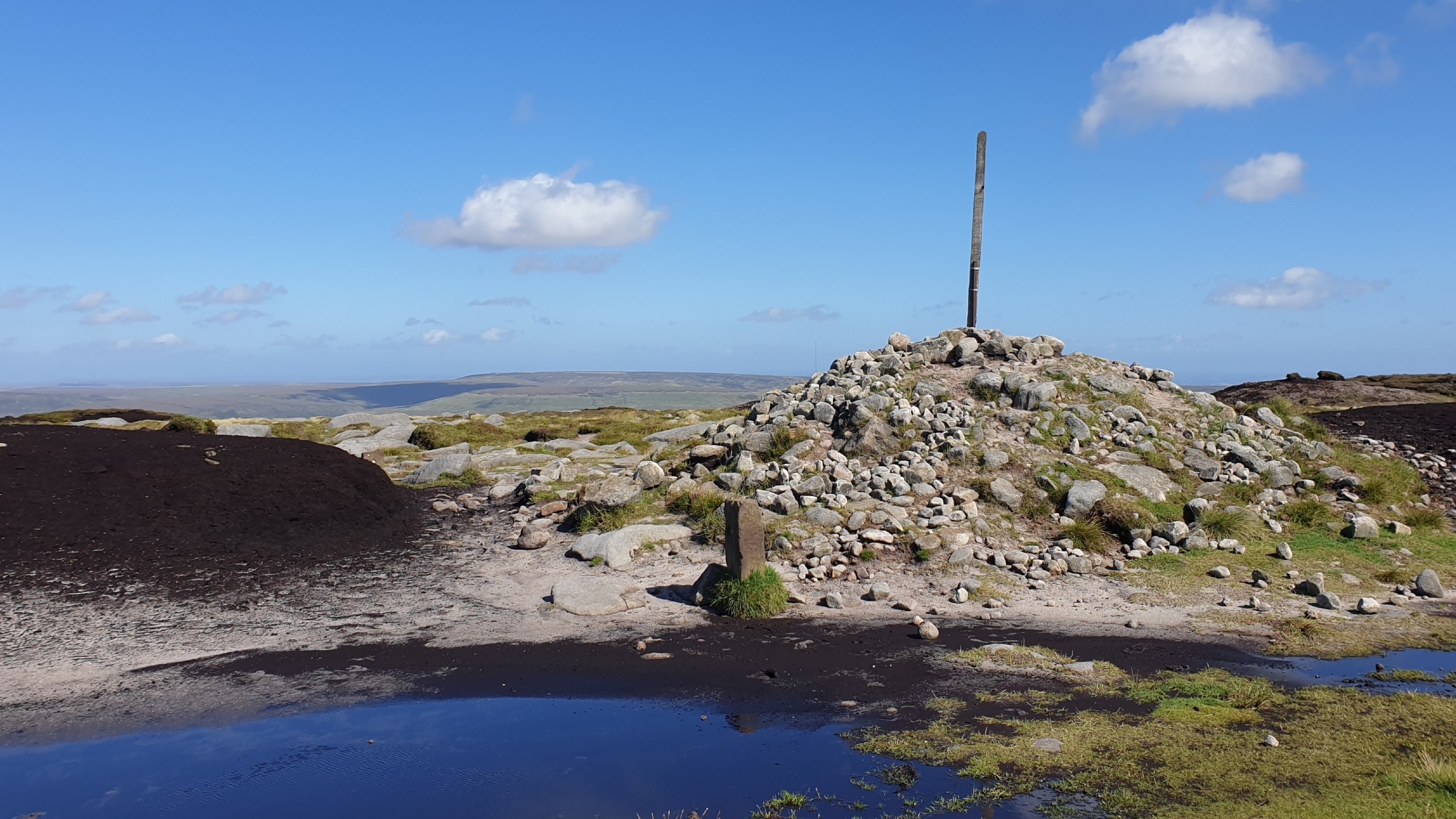
Bleaklow Head
©gritstoneedge.co.uk
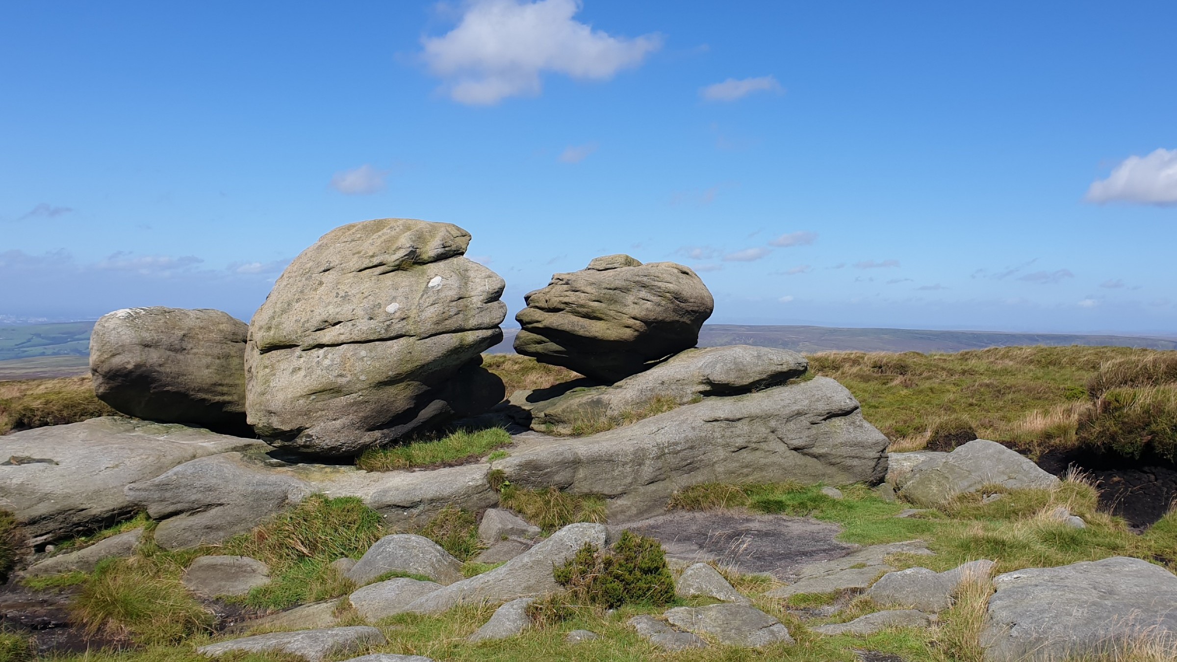
Wain Stones
©gritstoneedge.co.uk

On the way to Bleaklow Hill.
©gritstoneedge.co.uk

View over to Kinder
©gritstoneedge.co.uk

Looking up to Higher Shelf Stones
©gritstoneedge.co.uk

Higher Shelf Stones Trig Point.
©gritstoneedge.co.uk
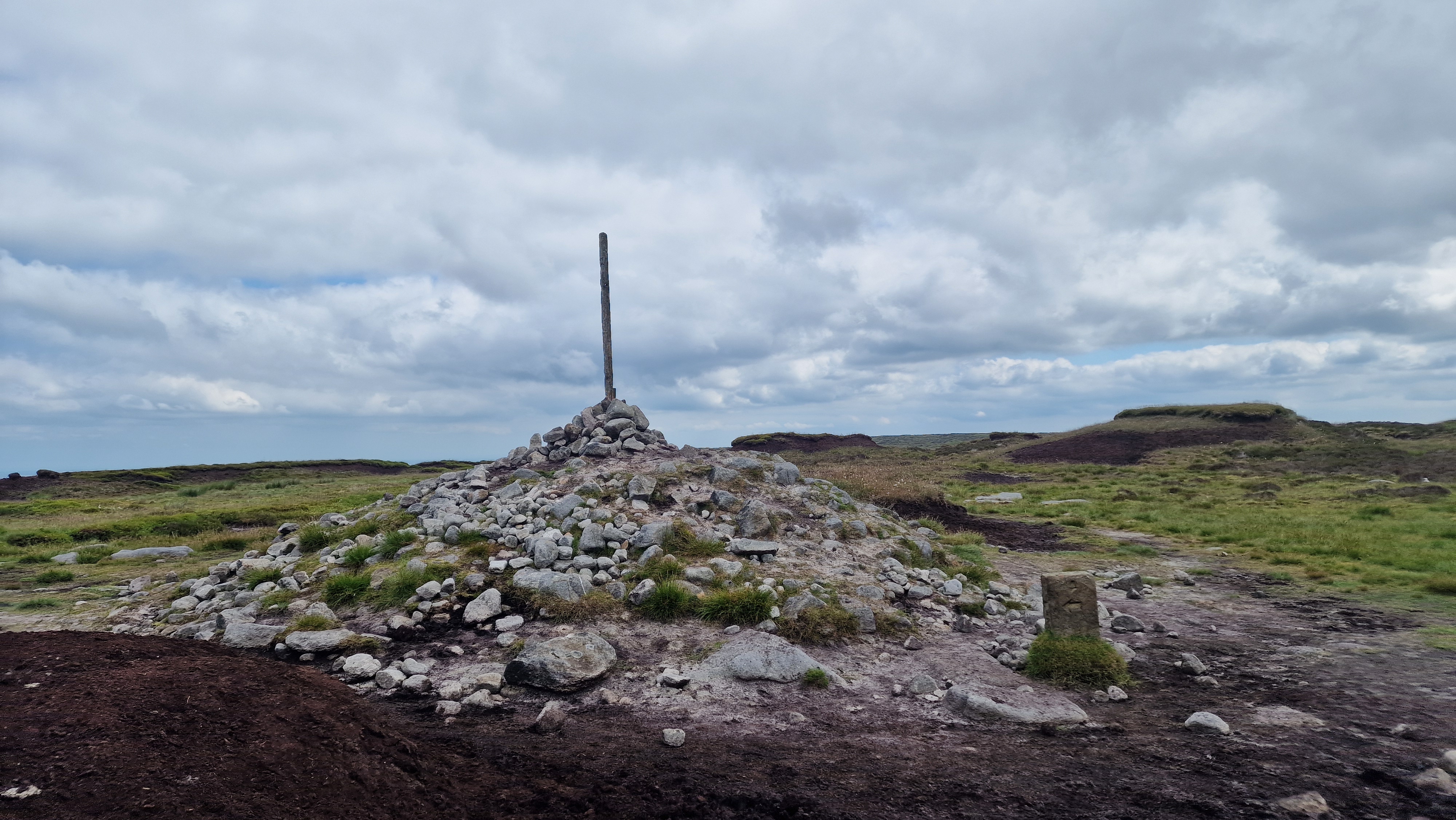
Bleaklow Head Stake and stones..
©gritstoneedge.co.uk
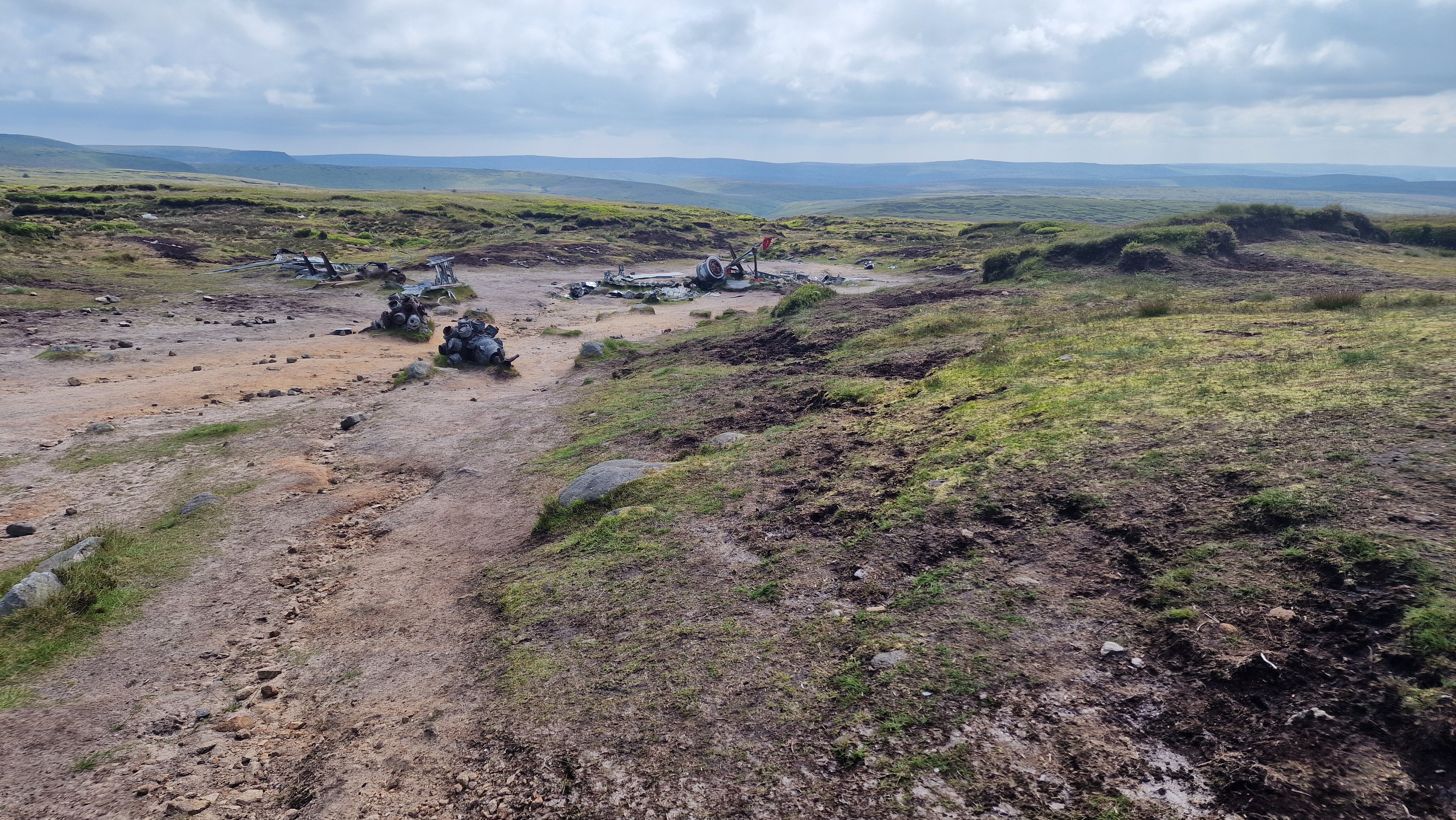
Aircraft wreck on Higher Shelf Stones
©gritstoneedge.co.uk

Rocks at Higher Shelf Stones.
©gritstoneedge.co.uk
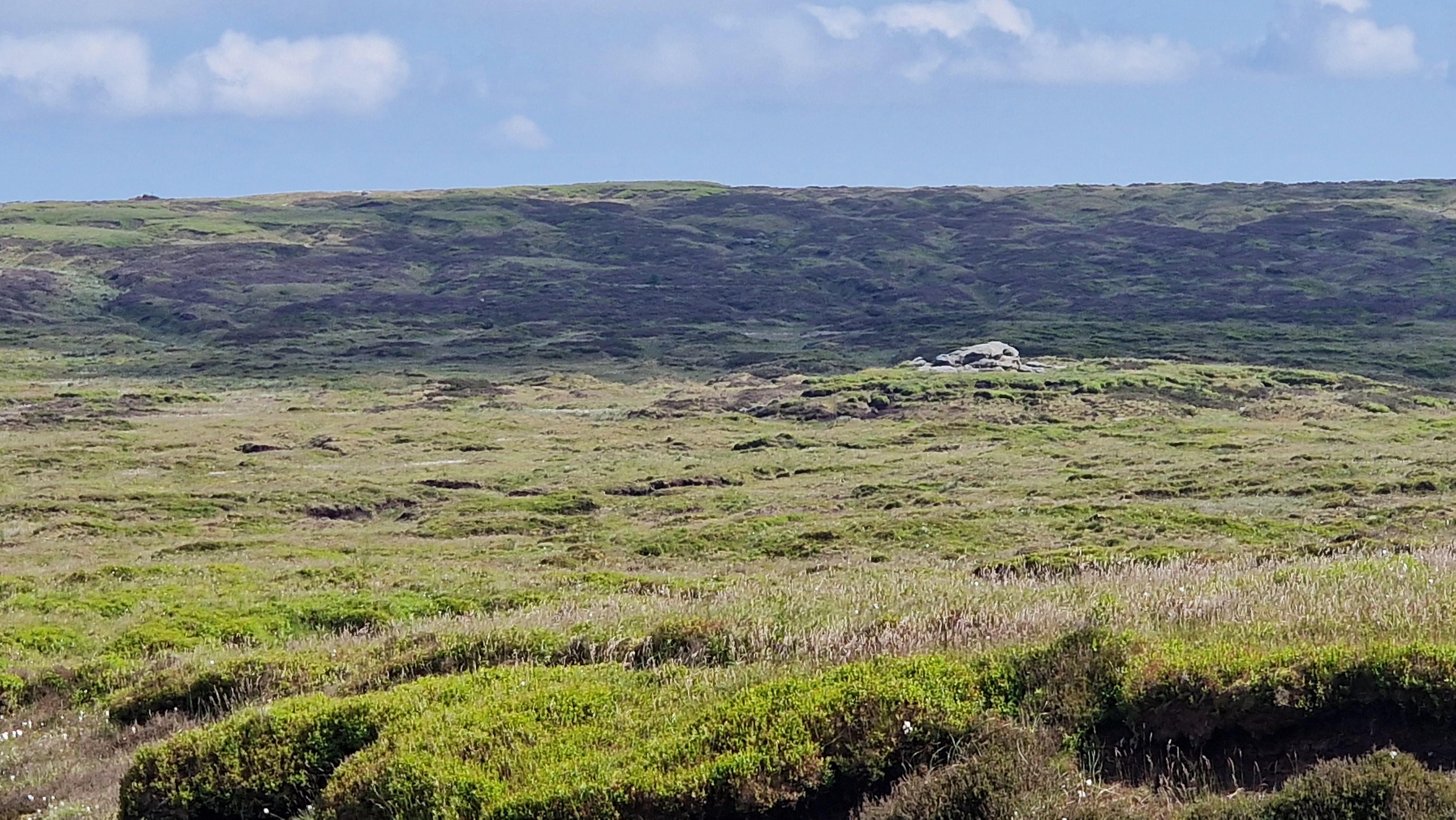
Hern Stones over to Bleaklow Head..
©gritstoneedge.co.uk
| Hill Summit : | Bleaklow Head[SK094960, 630m.] |
| Hill Summit : | Higher Shelf Stones[SK089947, 621m.] |
| Hill Summit : | Bleaklow Hill[SK105963, 630m.] |
| Hill Summit : | Bleaklow Stones[SK113963, 620m.] |
| Start : | Doctors Gate. Layby off the A57 east of Snake Summit.[SK096929 450m ] |
| Summary : | A57 (Doctors Gate) - Higher Shelf Stones - Hern Stones - Wain Stones - Bleaklow Head - Bleaklow Hill - Bleaklow Stones - Bleaklow Head - A57 (Doctors Gate) |
| distance : | 12.5km. |
| ascent : | 220m. |
| time : | 4hr. 10min. |
Bleaklow is a vast desolate moorland area between the A57 (Snake Pass) and the A628 (Woodhead Pass). The area around Bleaklow Head is the highpoint of this plateau, but is not much higher than the surrounding area. The Pennine Way cuts across Bleaklow and this route has the Pennine Way at the core. This route takes in Higher Shelf Stones, Bleaklow Head, Bleaklow Hill and Bleaklow Stones. In an attempt to improve Bleaklow much environmental work has been carried out. Gone are the vast swathes of dark exposed and eroding peat - now much of the area has good quality green grass. This has hidden many paths making this an area to explore again.
Glossop
Current Weather
Last Updated today at : 08:52:27
| Overall : | broken clouds |
| Temperature : | 10degC. |
| Wind Speed : | 21km/hr. |
| Wind Direction : | ENE |
| Clouds : | broken clouds |
| Precipitation : | none |
| Sunrise : | 05:36:01 |
| Sunset : | 18:45:43 |
| : | Times are GMT add 1 hour for BST |
Data from openweathermap.org
From the layby at Doctor's gate just on the east of Snake summit, go through the gate and follow the valley, up onto the moor. The path to the Penine Way has been much improved but can have wet and boggy patches. Turn right upon reaching the Pennine Way This path is excellent with a smooth hard core of sandstone or sandstone tiles. The route goes up Devils Dyke, an obvious cut through the moor. On turning around at the top of Devils Dyke, at Alport Low, there is a great view south over to Kinder. Continue along the path to cross Hern Clough. From here there is a smaller path straight ahead that goes over the moors towards Higher Shelf Stones. At the path junction climb up to Higher Shelf Stones. Follow this path over the moors. This reaches the crash site of a Super Fortress which crashed into the hilside in 1948. Walk solomnly up through the wreckage and then onto reach the trig point of Higher Shelf Stones.(3.0kms. 140m. 1hrs. 10min.)
The best way to Hern Stones is to walk on a bearing, but taking the paths when they appear. This area can be quite confusing, and remote, but there are paths on the ground if not on the map. Once at Hern Stones, follow the path due north to get to Wain Stones. This path runs parallel to the Pennine Way and is a good path. Given the correct angle, the Wain Stones look like they are kissing, the kissing stones. It is a simple walk along the good path to reach Bleaklow Head with the large cairn and stake. The actual true summit of Bleaklow is a small cairn on top of a peat hagg some 50m east of the large cairn at 633m. There are good views to the north over to Black Hill from Bleaklow Hill.(1.5kms. 40m. 0hrs. 40min.)
There is a path from Bleaklow Head over to Bleaklow Hill and Bleaklow Stones but it is indistinct in many places. Starting at Bleaklow Head, follow the path east, keeping to the stakes. These stakes, both short and tall, help the navigation to Bleaklow Hill and keep the walker on the right track. Bleaklow Hill is not marked with any cairn so you may wish to guess which lump is highest. There is a stake below the true top with some large flat stones. Continue along the same line of stakes to just south of Bleaklow Stones and then walk north to visit the stones themselves. From here the views south draw the eye down the many valleys that feed the Derwent Valley.(2.0kms. 20m. 0hrs. 40min.)
The return is via the uphill route back to Bleaklow Head and then down the Pennine Way. Turn around and walk south to the line of stakes and then west along the paths making to Bleaklow Hill and then onto Bleaklow Head. Navigation can enhanced here if you view your route on a GPS device or mobile phone ensuring that you are following the correct path. Trending down hillside to the south is to be avoided. Much of the land is confusing here. Once at Bleaklow Head follow the Pennine Way south back towards the snake pass. There are often many cars parked along the A57 at the snake summit. For change walk over to Snake Pass. At the road walk downhill, there is a complete path on the right (south) side of the road and often the road is not too busy. The start point is by the bridge at the steep bend.(6.0kms. 20m. 1hrs. 50min.)
24th Jun 2024 A hot summers day which was a change from the previous months of wet weather. There are some great views of Kinder (from Devils Dyke) Black Hill (from Bleaklow Head), the eastern edges from Bleaklow Stones, and Manchester from Higher Shelf Stones were great. Not too busy, as the route to the aircraft wreck often is.
20th August 2020 Post lockdown many of the popular areas on the UK hills are busy and the Pennine Way was no different. Many people asked me if they were on the correct way to see the crash site on Higher Shlef Stones. It was obvious that these people were prepared for the current sunny weather and good path but no more! However away from the Pennine way there were only a couple of fellow walkers. This pattern is seen all over the UK hills.
10th July 2020 The route follows the Pennine Way which makes it popular but today there were lots of people out. Many of them were more infrequent hill walkers, well looking at their clothing they were. I presume the popularity was down to the relaxing of lockdown and no school yet. Much was surprising as it was wet for most of the morning although the sun cam out later.
28 March 2019 End of March 2019 and it is Spring, in fact it is as warm as summer. Spent a long time at Higher Shelf Stones over lunch in the sunshine. The ground is a lot wetter than last visit. The route from Hern Stones to Higher Shelf Stones is particularly boggy. Could be due to the wet winter as compared to the dry summer of last year. Really nice route in the sunshine
Use this link to view all the external gritstoneedge.co.uk resources.
 gritstoneedge linktr.ee
w : https://www.gritstoneedge.co.uk
e :
 gritstoneedge Blog
 gritstoneedge instagram
 gritstoneedge YouTube channel
 gritstoneedge Podcast
Disclaimer :This site has links to many adventures in the outdoors, walking or cycling in hills and moors, within the UK. These can be dangerous activities. Conditions can change rapidly in the outdoors. The information and links provided on this site is given in good faith. gritstoneedge.co.uk cannot be held responsible for any loss or injury caused by encouraging you into the outdoors of by the accuracy of the information provided on this site.
© gritstoneedge.co.uk all rights reserved 2015-2025